

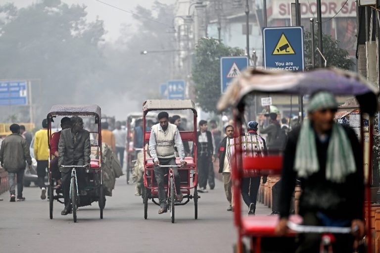
South Asia remains the region with the world’s worst air pollution. A surprise improvement in air quality...
Phys.org
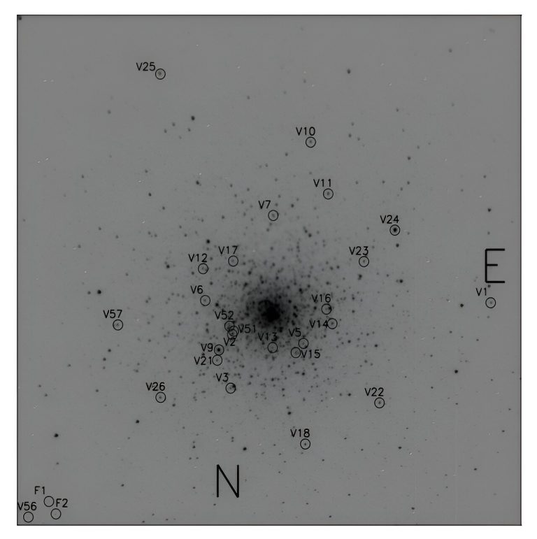
Identification chart of variable stars in the field of NGC 1851. Credit: Ferro et al., 2024. Astronomers...
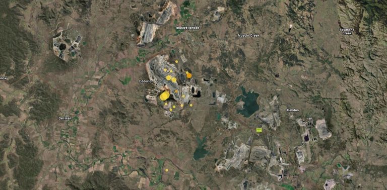
Recent earthquakes near Muswellbrook. Credit: Geoscience Australia, CC BY On Friday 23 August, a magnitude 4.8 earthquake...
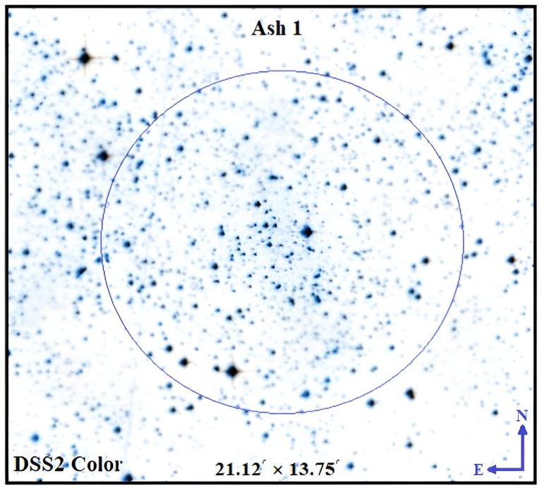
Image of Ash-1 obtained at DSS2-colored optical wavelength in ALADIN sky atlas. Credit: Tadross et al., 2024....
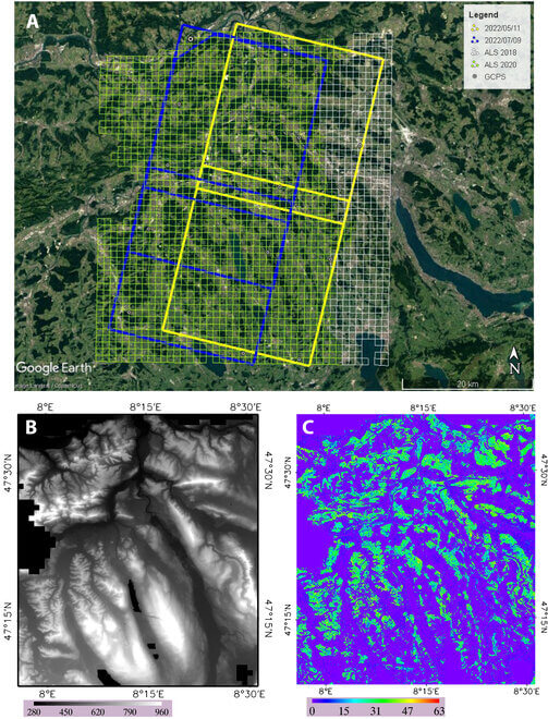
Datasets and spatial coverage used in Switzerland. Credit: Journal of Remote Sensing (2024). DOI: 10.34133/remotesensing.0158 Scientists have...

Spatial patterns of drought and vegetation damage characteristics. Credit: Remote Sensing of Environment (2023). DOI: 10.1016/j.rse.2023.113512 More...
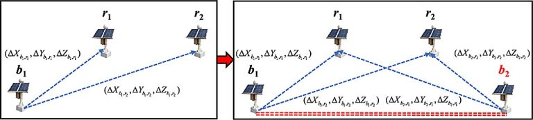
Deformation Monitoring Networks: Single-Base vs. Dual-Base Constraint. Credit: Satellite Navigation (2024). DOI: 10.1186/s43020-024-00148-3 Deformation monitoring plays a...
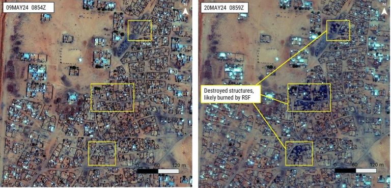
Comparison photos of an area of El Fasher, North Darfur, Sudan showcasing the destruction of civilian property...
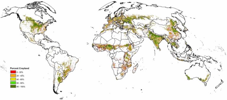
The final hybrid cropland map (as % cropland) at a 500 m resolution. Credit: Environmental Research Letters...
Sentinel-2C being lifted onto the Vega launch adapter. Credit: ESA-CNES-ARIANESPACE/Optique vidéo du CSG–S. Martin As preparations continue...


