

Credit: Wikimedia Commons/Yourong F. Wang, CC BY-SA New Zealand’s space sector has been developing rapidly since the...
Phys.org
Credit: Pixabay/CC0 Public Domain Species are disappearing at an alarming rate around the world. But Australia’s extinction...
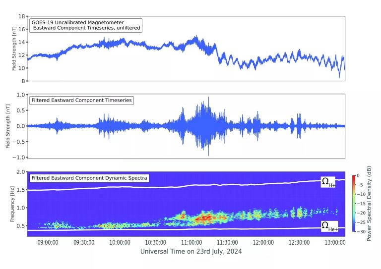
Credit: NOAA Headquarters The Goddard Magnetometer (GMAG) instrument, launched onboard NOAA’s GOES-19 satellite on June 25, 2024,...

Credit: Pixabay/CC0 Public Domain The National Oceanic and Atmospheric Administration predicts the 2024 Atlantic hurricane season will...
Credit: European Space Agency The effects of the climate crisis are felt more acutely in the Arctic...
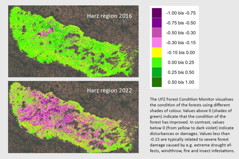
According to the UFZ forest condition monitor, 52 percent of the forest on the whole and particularly...
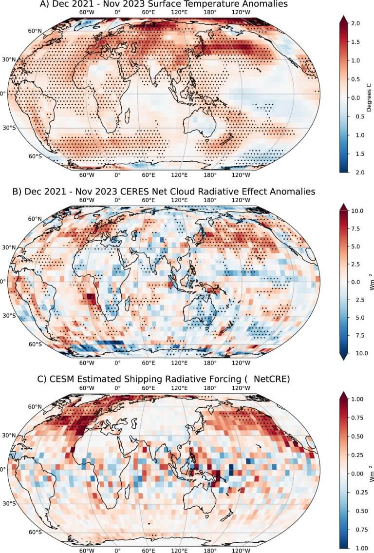
(a) Surface temperature anomalies from NOAAGlobalTemp data set for Dec 2022–Nov 2023. Anomalies are relative to 2000–2019...
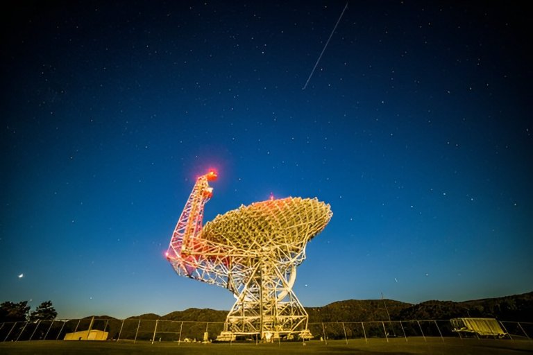
The NSF Green Bank Telescope. Credit: NSF/AUI/NSF GBO/J. Seymour Astronomers learn about the universe by pointing their...
Credit: Unsplash/CC0 Public Domain A tiny seed is stuck between loose gravel and coarse sand. There is...
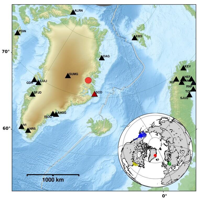
Overview of seismic stations on Greenland (black triangles), the location of the tsunami (red circle) and the...


