

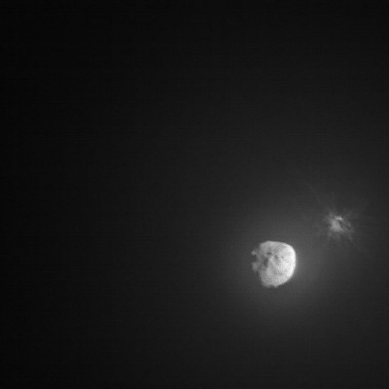
Image captured by the Italian Space Agency’s LICIACube a few minutes after the intentional collision of NASA’s...
Phys.org
Credit: Unsplash/CC0 Public Domain In the arid American West, wildfires now define summer. Recent years have seen...
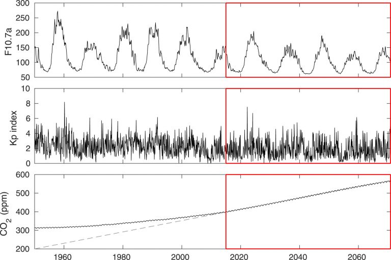
The F10.7a index of solar activity (top), KP index of geomagnetic activity (middle) and the global mean...

Credit: Griffith University Ten humpback whales have been tagged with satellite transmitters off the coast of Ecuador...
Credit: CC0 Public Domain By 2050—just 28 years from now—the sea level along the Long Island Sound...
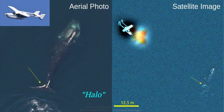
Identifying “Ruffian” via an aerial photograph compared to a satellite image. Credit: University of Ottawa / Canadian...
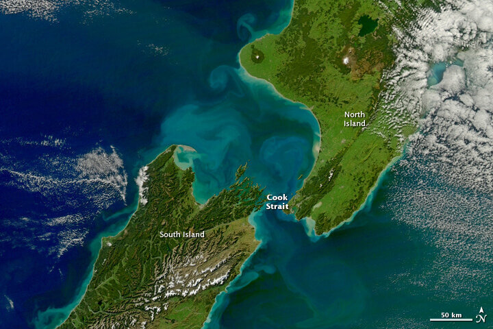
Satellite view of a section of New Zealand’s North Island and South Island. Credit: NASA Runoff from...
Earth’s night lights as observed in 2016 based on NASA’s Black Marble Product. Credit: NASA When the...
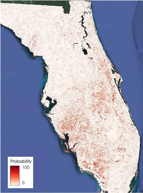
Satellite images and artificial intelligence reveal Hurricane Ian’s widespread damage. The dark areas have a high probability...
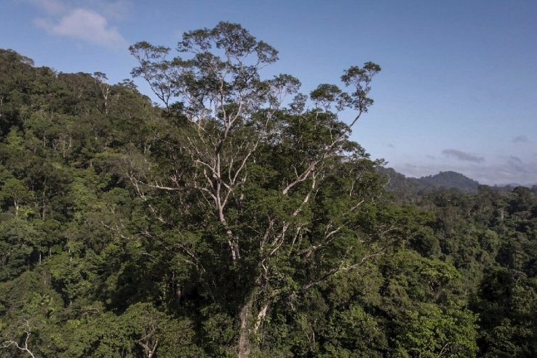
This handout picture released by NGO Imazon shows an Angelim Vermelho tree (Dinizia Excelsa Ducke) which is...


