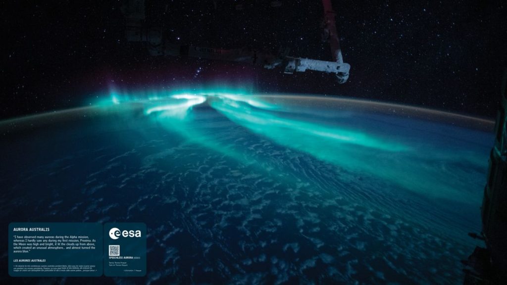
Planned NASA mission to the ‘ignorosphere’ could improve space weather forecasts (Image Credit: Space.com)
There is a layer of Earth’s atmosphere that scientists know very little about. Dubbed the “ignorosphere,” this layer at the edge of space plays a huge role in determining the intensity of space weather events.
A new space mission is in the works that will attempt to shed more light on the processes that take place there, but it won’t be ready before the current solar cycle ends.
When bursts of charged particles from the sun that form the solar wind hit Earth, strange things happen in the planet’s gaseous coat. Those heavy particles (protons, electrons and heavy ions) collide with atoms in the upper atmosphere, energizing them, Juha Pekka Luntama, the head of space weather at the European Space Agency (ESA), told Space.com.
Related: Solar storms can destroy satellites with ease — a space weather expert explains the science
Most of this energy exchange happens in the thermosphere, the second-highest layer of Earth’s atmosphere that extends between altitudes of 60 miles to 360 miles (100 to 600 kilometers). The excess energy warms up the thermosphere and makes it swell. The density of the thin gases that fill this region of space increases. In turn, satellites in low Earth orbit face more drag and sometimes prematurely fall to Earth.
“It’s like running against the wind,” Anja Stromme, the manager of ESA’s Swarm mission, which recently experienced problems maintaining altitude due to bad space weather, told Space.com.
Most of these changes happen in the lowest layer of the thermosphere at altitudes of 60 miles to 120 miles (100 to 200 km), just above the Karman line, a widely recognized boundary between Earth’s atmosphere and outer space. Scientists sometimes call this region “the ignorosphere,” due to the dearth of data collected there.
“It’s too high for balloons but too low for satellites,” said Stromme.
Without these measurements, space weather forecasters have little means to improve their predictions of changes that happen in this region in response to solar flares and other sun eruptions. They have no way of providing proper insights to satellite operators whose spacecraft are at risk. In February this year, SpaceX experienced first hand how serious this risk can be when it lost 40 brand-new Starlink satellites that were victimized by bad space weather right after launch.
“When we see an event on the sun, we can give a warning to satellite operators to be cautious and aware,” Luntama said. “But it’s very difficult to forecast exactly how big the impact is going to be and how much the atmospheric drag for the satellites will increase.”
NASA and ESA have plans for a satellite mission that would help fill those gaps. Making such a mission work, however, is quite a challenge, as it would be at very high risk of succumbing to the exact phenomenon it would be launched to study.
“The problem is that, in this region, around 150 kilometers [90 miles] from Earth’s surface, there is still too much atmosphere to slow satellites down,” said Luntama. “If you were flying a mission there, it would stay in orbit only for a short time, and then it would spiral into the atmosphere and burn.”
The two space agencies want such a mission to remain in orbit for years so that it gets exposed to space weather events of various frequency and intensity. The frequency with which the sun produces sunspots, which are the source of solar flares and eruptions that affect Earth, varies based on the sun’s 11-year cycle of activity. To ensure that such a mission keeps providing insights as the sun moves through this cycle, mission engineers have to very carefully design the spacecraft’s orbit so that it makes only very brief dips into the low altitudes of the ignorosphere while following an elliptical path.
“The perigee [the closest point to Earth] should be between 100 and 150 kilometers [60 and 90 miles] so that we can get the measurements,” said Luntama. “The apogee [the farthest point from the planet] should be several hundreds of kilometers — 500 or 600 km [300 or 360 miles] — which is clearly away from the atmosphere.”
The spacecraft would circle the planet about every 90 minutes, Luntama said, using an on-board propulsion system to compensate for the loss of speed during the flight through the dense low-lying regions.
“We would like to measure the charged particles [from the sun] but also the density of the atmosphere in this region,” said Luntama. “We also need information about the magnetic field of Earth, because that changes during solar storms. And lastly, we need precise information about how the atmosphere slows down the satellite.”
The mission, however, is still in the planning stages and will not make it into the ignorosphere before this solar cycle ends, Luntama added.
“We have established a science team that consists of scientists from Europe and the U.S., and we are now working on defining the mission,” Luntama said. “Once we define more precisely the mission objectives and the measurements that we want, then the engineering teams can start to look at how to build such a mission that can do this.”
In the meantime, solar weather experts do what they can to improve their forecasts while the sun keeps exceeding their earlier predictions, producing many more sunspots, solar flares and eruptions than expected. After its first-hand encounter with the whims of space weather, SpaceX joined forces with the U.S. National Oceanic and Atmospheric Administration (NOAA) and started providing some basic data about the drag Starlink satellites experience during orbit-raising after launch, Tzu-Wei Fang, a NOAA space scientist, told Space.com in an earlier interview.
NOAA uses this information to improve its Whole Atmosphere Model, which attempts to predict space weather near Earth just like meteorologists model weather on the planet.
Follow Tereza Pultarova on Twitter @TerezaPultarova. Follow us on Twitter @Spacedotcom and on Facebook.


