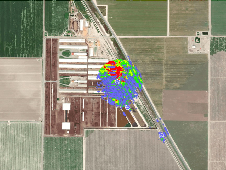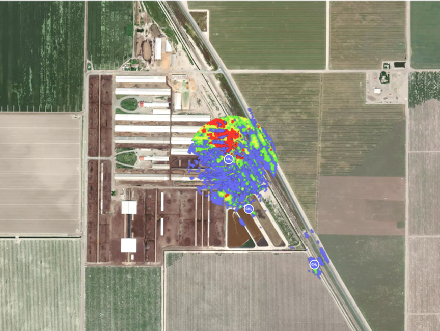
Methane satellites will be watching California’s dairies…but mostly its oil fields and landfills (Image Credit: Sat News)

California is doubling down on its spending for launching new satellites to capture images of methane leaks throughout the state. But the dairy sector—long in the regulatory crosshairs for climate emissions—is taking a backseat on this space mission, according to some sources.
The state budget has allocated $100 million in revenue from California’s cap-and-trade program to invest in expanding the number of satellites launched for methane observations. The information gathered from the monitoring enables the Air Resources Board (CARB) to identify the sources of these emissions and hold polluters accountable for violations. It also advances the state’s goals for reducing the short-lived climate pollutant—a way to slash the overall impact of greenhouse gas emissions more quickly than through carbon dioxide emissions, which linger in the atmosphere longer and are more prominent but less potent.
According to researchers at UC Davis, Agriculture contributes just 11% of the total GHG emissions in the U.S., making it the smallest GHG emissions contributor of any sector tracked by the Environmental Protection Agency. Of the 11% of GHG emissions from agriculture, research indicates about 3% of agricultural GHG emissions come from livestock, according to a blog post.
But, according to CalEPA Secretary Jared Blumenfeld, who lauded the governor’s proposal in May, the “most egregious methane leaks” are “destroying our climate and polluting our communities.”
Dairies initially stood at the center of CARB’s efforts to survey methane emissions. In 2016 the agency collaborated with NASA’s Jet Propulsion Laboratory, University of Arizona scientists and the California Energy Commission to outfit planes with sensitive remote sensing cameras—a technology 30 years in the making.
After surveying more than 300,000 pieces of infrastructure, they found that less than 2% of those facilities were responsible for as much as half of the state’s entire contribution of methane emissions. A subsequent study in 2019 pointed to landfills as the largest contributor, at 41 percent, while dairies and the oil and gas sector tied for second, with 26% each.
Detecting and repairing those initial leaks was the low-hanging fruit in solving the problem, according to Riley Duran, a research scientist and CEO of Carbon Mapper, a nonprofit organization leading public-private partnerships in this area. Speaking at a State Board of Food and Agriculture hearing this month, Duran explained how the effort boils down to two types of emissions.
Oil and gas production, natural gas transmission lines, landfills and wastewater treatment plants make up high-emission point sources—along with confined animal feeding operations, particularly those involving wet manure management. Area emissions, meanwhile, would include enteric fermentation from hundreds of head of cattle that may independently emit relatively small amounts through belching but collectively produce a significant source. Tracking down such sources in agriculture is less about fixing leaks—though dairy digesters capturing that methane do leak on occasion—and more about understanding systemic challenges across the sector.
After the initial flyovers in the pilot program, CARB notified facility operators of the leaks and about 40 of those operations immediately cut their emissions. The voluntary repair actions led to a reduction in enough methane to equal nearly 1.5 million metric tons of carbon dioxide emissions.
CARB shared the initial findings with the dairy sector as well. Follow-up flights over the San Joaquin Valley last fall showed that newly constructed digesters have led to substantial reductions. Of the many high-emitting dairies pinpointed in 2016, only a handful of plumes are still active, according to preliminary findings Duran shared.
Now Carbon Mapper and its partners across 15 states are looking to scale up the effort and expand into space. With the commercial satellite company Planet Labs and through philanthropic funding, Carbon Mapper plans to launch two methane satellites in late 2023.
“We’re in a hurry to do something about this,” said Duran. “Rather than try to fit this into existing federal research programs, we went out and sought and secured philanthropic funding to launch our satellites.”
In its search for dollars, the organization touts leading figures in the field on its board of directors, with former CARB Chair Mary Nichols and CARB’s recently retired executive officer, Richard Corey.
Meanwhile, the $100 million in state spending triggered concerns in the Legislature in May about the potential return on investment, indicating apprehension even within one of the nation’s most climate-forward governments. Sen. Bob Wieckowski of Fremont, who chairs a budget subcommittee, questioned why the state should spend so much on a technology that may or may not bring down emissions indirectly, when it could spend that on dairy digesters, a technology known to reduce emissions more than any other state program.
Yet headlines over major leaks and oil spills in California have solidified public sentiment around the issue. Realtime satellite monitoring would have quickly detected the massive Aliso Canyon rupture in 2015, when a natural gas pipeline released 109,000 metric tons of methane into the atmosphere.
The satellites present an opportunity to tackle more shovel-ready projects like repairing oil and gas leaks, which is why dairies are not a major focus in the latest prototyping from CARB, according to Duran.
“If they know where it is, in many cases they can fix it the next day,” he said. “It doesn’t require a big investment.”
The technology also allows CARB to monitor a much wider area from space and fifth generation instruments will capture more detail than the planes were able to. An average consumer camera captures light in three colors, explained Duran, but the satellite cameras will cover nearly 500 colors and at the same time quantify the amount of gas in the atmosphere.
The opportunities for monitoring greenhouse gas emissions have also piqued the interest of Vice President Kamala Harris, who visited the Chabot Space and Science Center in Oakland last week to announce a new public-private partnership for commercial space flight.
“Soon a new generation of satellites will help us fight the climate crisis by tracking and allowing us to see the patterns of greenhouse gas emissions and to see that in real time,” said Harris.
From Agri-Pulse
By Sara Wyant and Brad Hooker


