

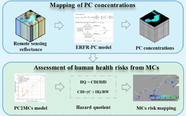
Credit: Water Research (2023). DOI: 10.1016/j.watres.2023.120648 Under the combined impact of climate changes and human activities, many...
Satellites
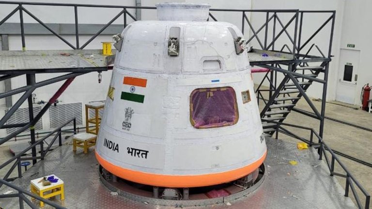
After smashing the game with its successful Chandrayaan-3 moon mission and crossing off milestones for its Aditya-L1...
Credit: CC0 Public Domain Emissions associated with mining operations in Africa’s Copperbelt can be quantified from space,...
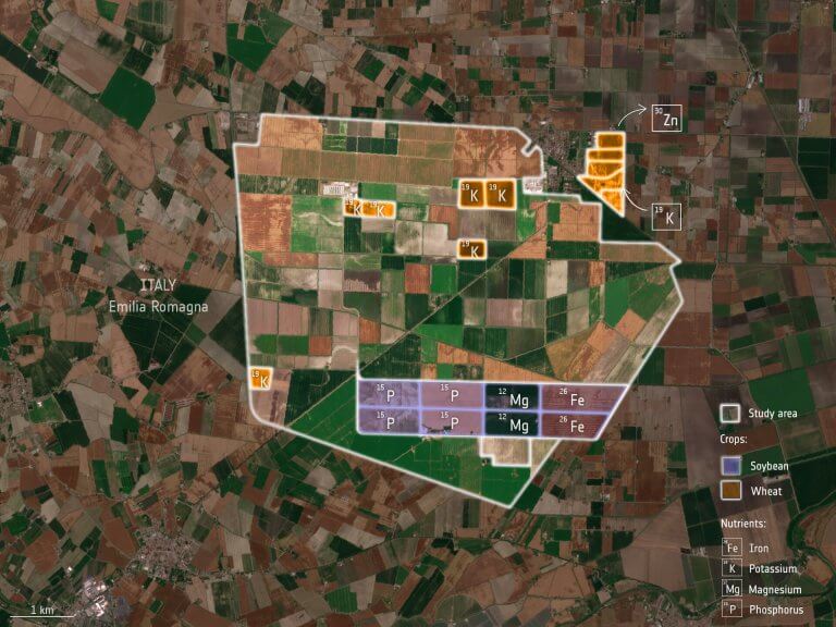
ESA-funded research shows that the Copernicus Sentinel-2 mission and the Italian Prisma mission could be used to...
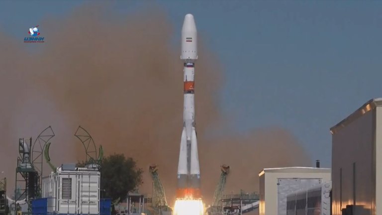
Iran plans to hold talks with Russia over assistance to build a new Khayyam remote-sensing satellite. Discussions...
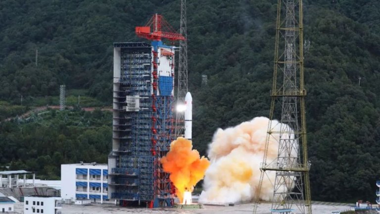
China added a trio of new satellites to its clusters of Yaogan orbital reconnaissance spacecraft last week....
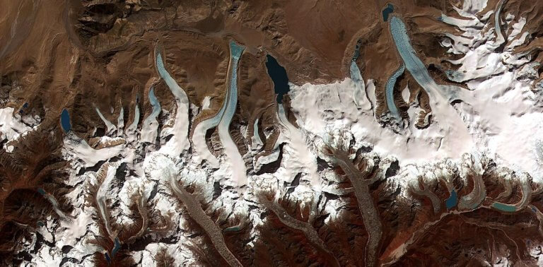
Glacial lakes are common in the Himalayas, as this satellite view shows. Some are dammed by glaciers,...
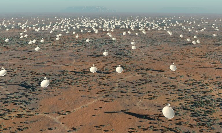
Artist’s impression of the 5km diameter central core of Square Kilometre Array (SKA) antennas. Credit: SPDO/TDP/DRAO/Swinburne Astronomy...
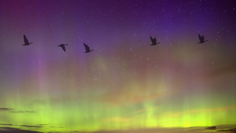
New research indicates that severe space weather events, such as solar flares, disrupt birds’ navigational skills during...
A massive iceberg around half the size of Rhode Island recently smashed into a penguin refuge in...


