

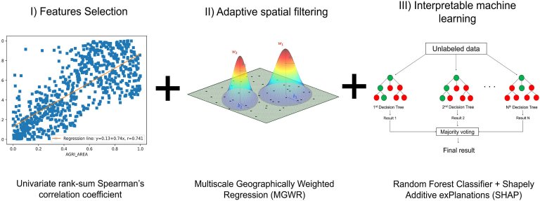
Graphical representation of the three functional blocks put in series in the ensemble GeoAI architecture implemented to...
Satellites
Credit: Andrew Hanson from Pexels A team of researchers from Alaska Pacific University, the University of Alaska...
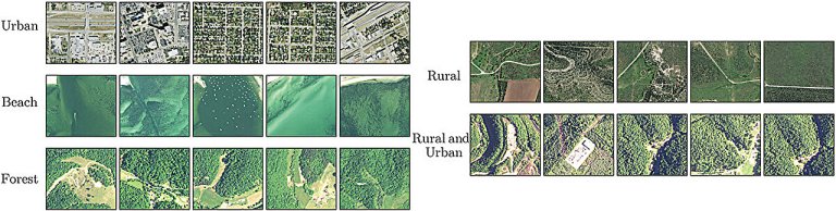
NAIP imagery patches 1–5 (left to right) for each geographical type. Credit: Remote Sensing Letters (2024). DOI:...

ST Engineering iDirect and AITELECOM/APCO are expanding their partnership to deploy new, cutting-edge technology on the SES...
A NASA satellite almost got clobbered high above Earth this morning (Feb. 28). At 1:34 a.m. EST...
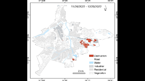
Time lapse video shows the cumulative effects of the Russian campaign against Bakhmut. When researchers “saw the...
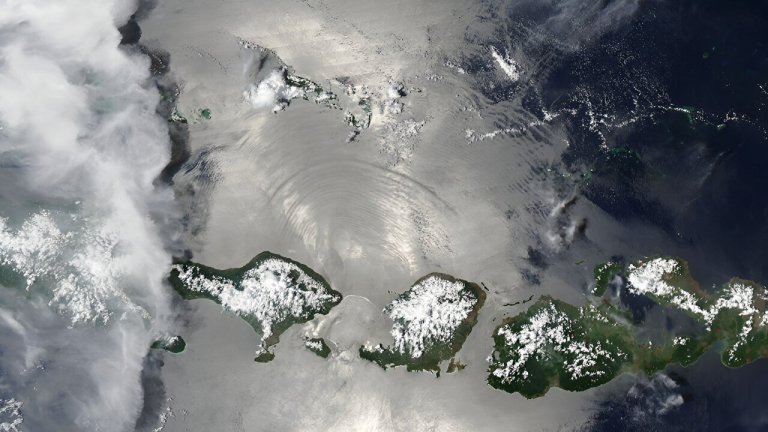
Internal waves are generated when tides beneath the surface pass over seamounts, continental slopes, ridges, or other...
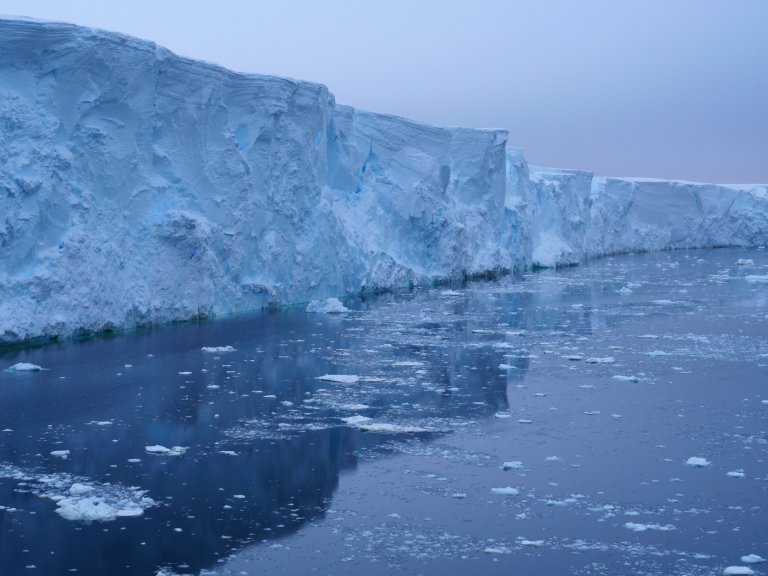
Thwaites Glacier, western Antarctica, 2019. Credit: Robert Larter Among the vast expanse of Antarctica lies the Thwaites...
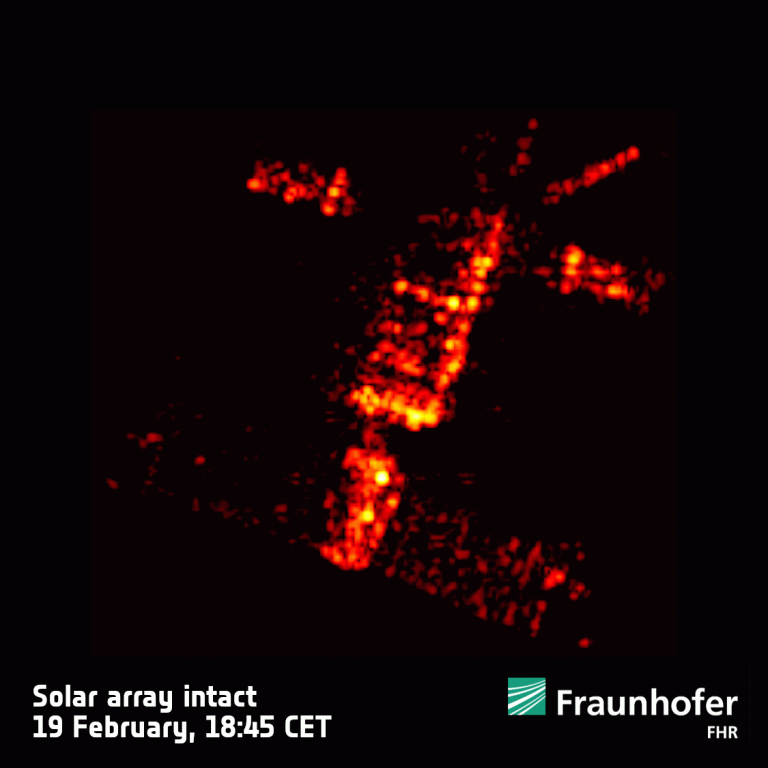
Credit: Fraunhofer FHR Following a hugely successful mission and almost 30 years in orbit, ESA’s ERS-2 reentered...

Further embracing the New Space era, ESA is to develop two new Scout satellites: NanoMagSat and Tango....


