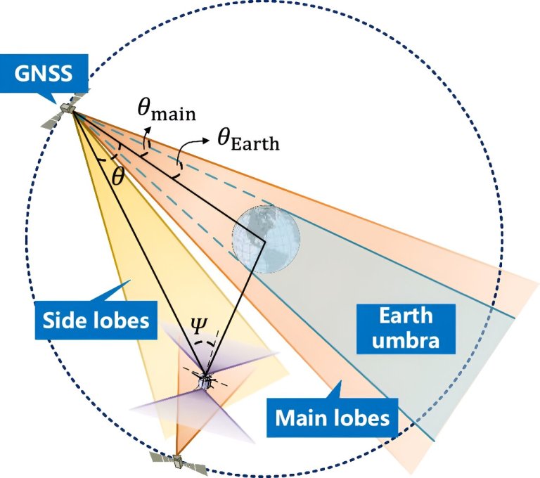
Geometry between GNSS satellites, spacecraft, and the Earth: spacecraft can receive GNSS signals from both the zenith...
Satellites
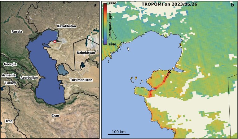
Well blowout at the 2023 Karaturun East leak. a, Location of well no. 303 (45.3324°N, 52.3730°E) in...
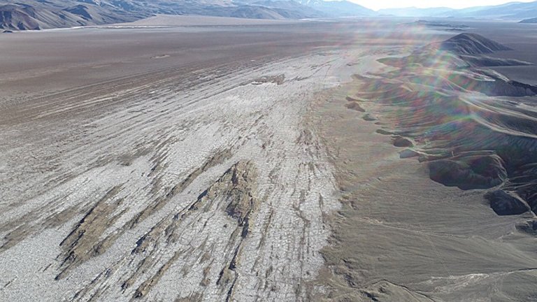
New research tracked the evolution of stress and crustal deformation in the Puna region of the Andean...
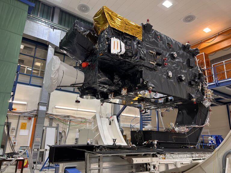
The first Meteosat Third Generation Sounder (MTG-S1) satellite ready to go into the thermal vacuum chamber where...
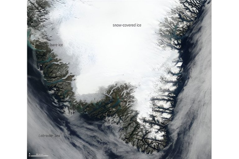
Photo-like satellite image of southern Greenland on the afternoon of September 4, 2022. Bare, dirty ice at...
A Soyuz-2.1b rocket with a Glonass satellite blasts off from the Plesetsk launch pad in northwestern Russia....
For the second time in a row, Lockheed Martin will be at the forefront of the creation...
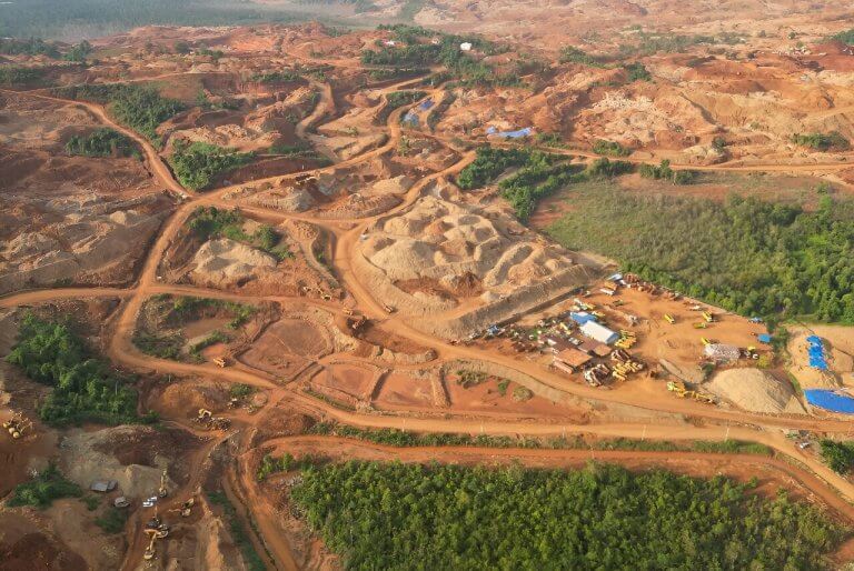
Indonesia’s nickel reserves are the world’s largest. More than 700,000 hectares of forest in Indonesia have been...
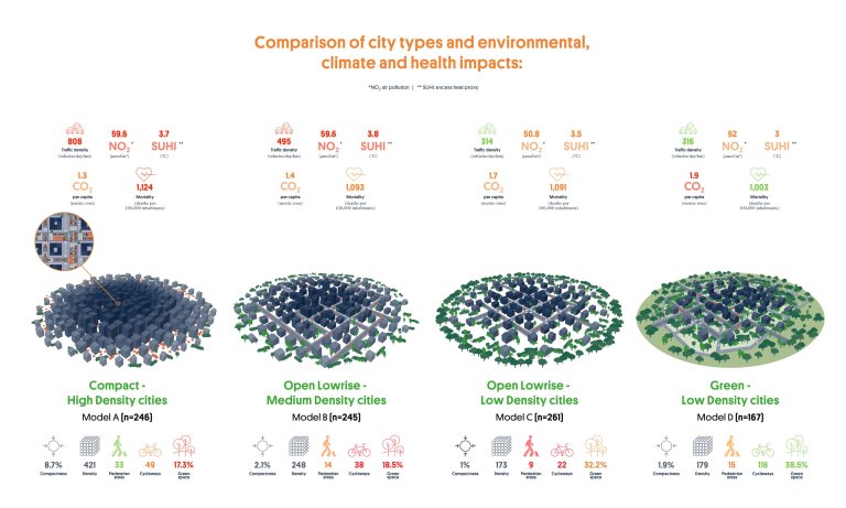
A study by ISGlobal identifies the four city types in Europe and compares their carbon emissions, mortality...
ESA’s Φsat-2 is a dedicated Artificial Iintelligence (AI) mission which will fully explore the benefits and capabilities...


