

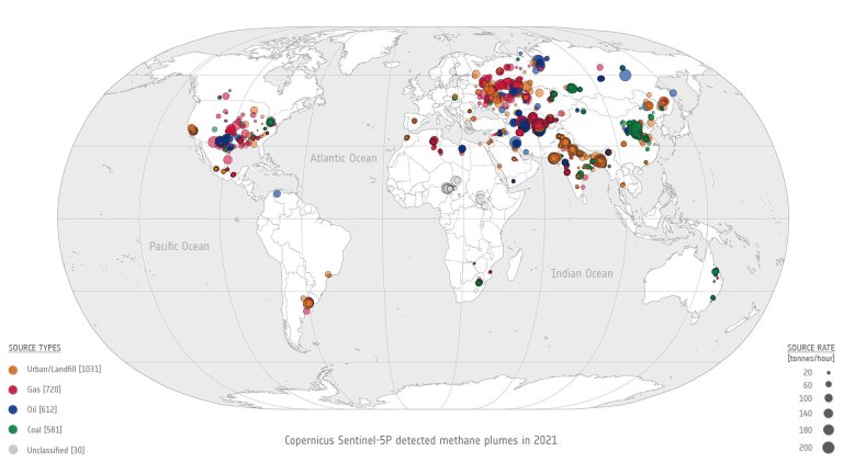
Global overview showing the location and magnitude of all 2,974 methane super-emitter plumes detected in 2021 using...
Phys.org
Socially vulnerable populations are disproportionately exposed to wildfires in the West, study finds

Socially vulnerable populations are disproportionately exposed to wildfires in the West, study finds
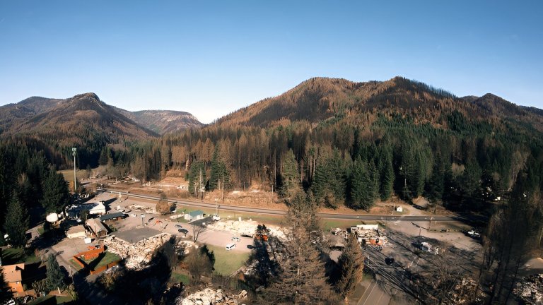
Fire damage in the city of Detroit, Oregon, and the Oregon Cascades can be seen in this...
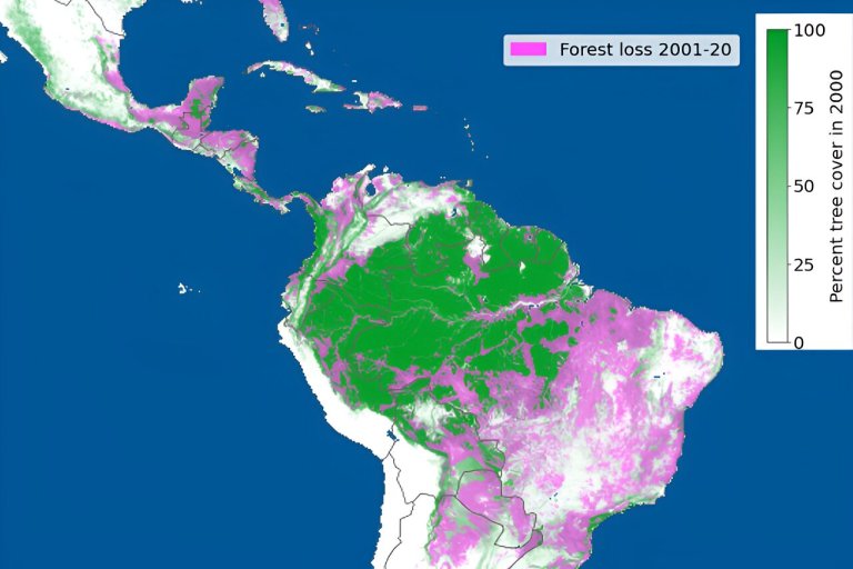
This figure shows forest loss between 2001 and 2020. The loss of forest is shown in pink....
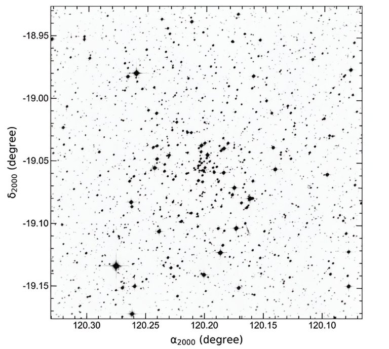
Identification chart of stars located through the area of NGC 2509. Credit: arXiv (2023). DOI: 10.48550/arxiv.2309.05037 Using...

STELLA (short for NASA’s Science and Technology Education for Land / Life Assessment) is a handheld, do-it-yourself...
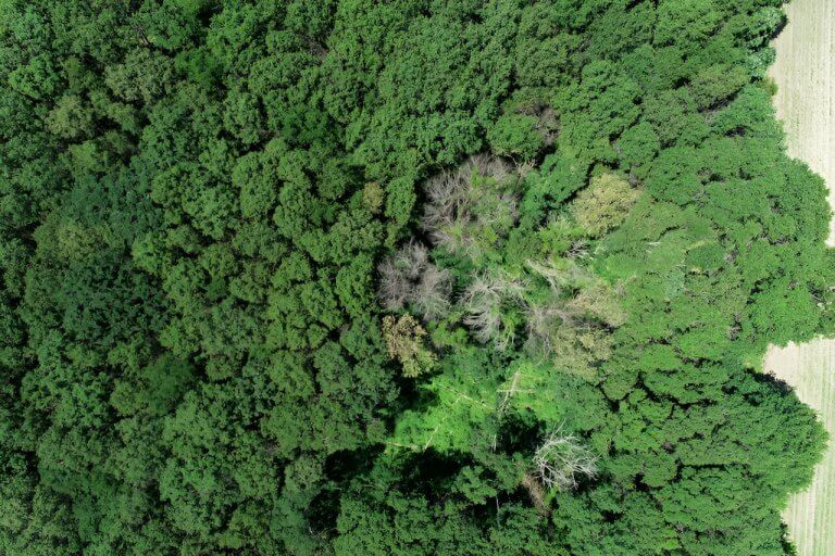
An aerial view of oak wilt impacting trees in Sherburne County. Credit: University of Minnesota. As our...

Mt. Edgecumbe rises in the foreground with Crater Ridge behind and to the north on May 19,...
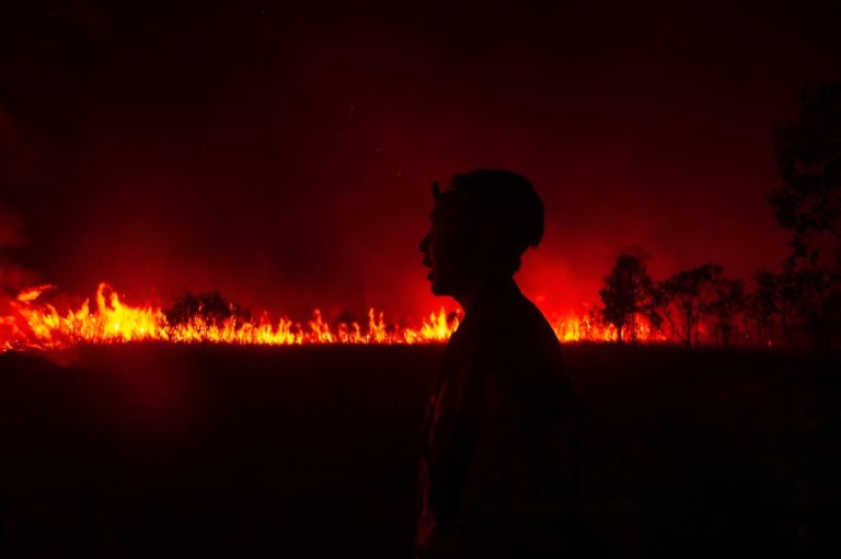
The fire has burned through 75 hectares of peatland in the Ogan Ilir regency of South Sumatra...

Credit: NASA International Space Station program People have been using fire for millennia. It is a vital...

The testing of NOAA’s GOES-U satellite was conducted at Lockheed Martin Space’s Littleton, Colorado, facility, where GOES-U...


