

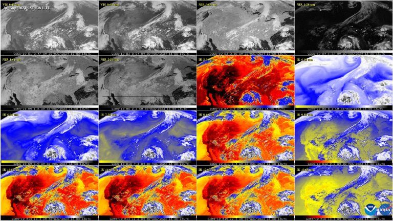
This GOES-19 image shows the contiguous United States observed by each of the ABI’s 16 channels on...
Phys.org
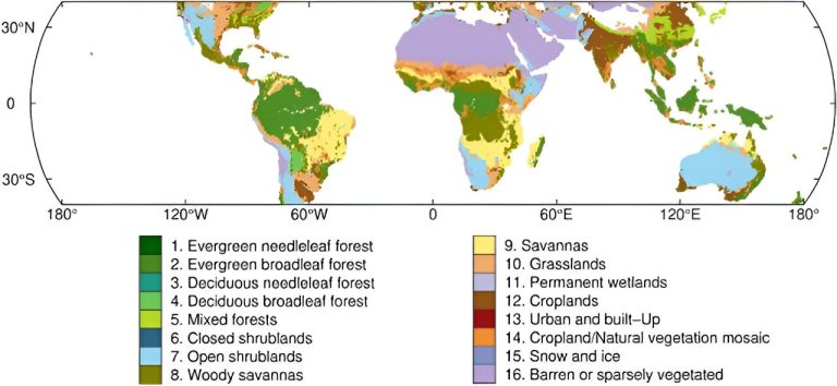
Global land cover categories of IGBP from SMAP product (40°S–40°N). Credit: Satellite Navigation A pioneering method for...
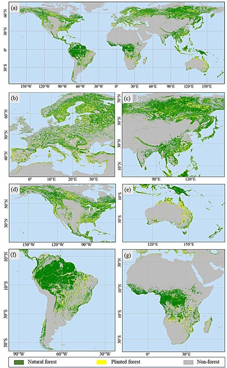
(a) Global; (b) Europe; (c) Asia; (d) North America; (e) Oceania; (f) South America; (g) Africa. Credit:...

Nanjing, where the research team is based, experienced consecutive hot summer days of nearly 40℃ in August....
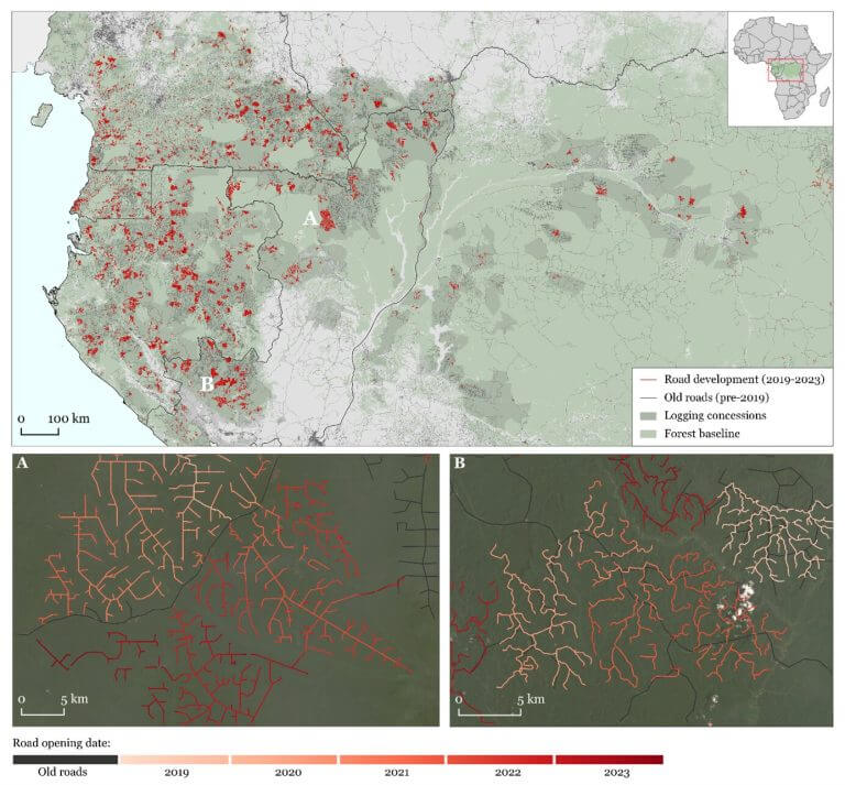
Road development in the Congo Basin forest during the last five years. Credit: Remote Sensing of Environment...
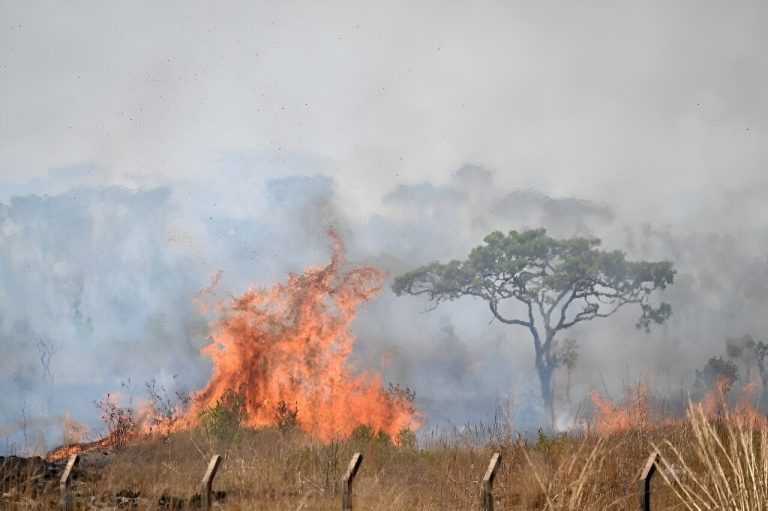
Brasilia is battling its worst fires of the year so far. Brazilian firefighters on Monday battled flames...
Credit: CC0 Public Domain Iran on Saturday blasted a new research satellite into orbit, state media said,...
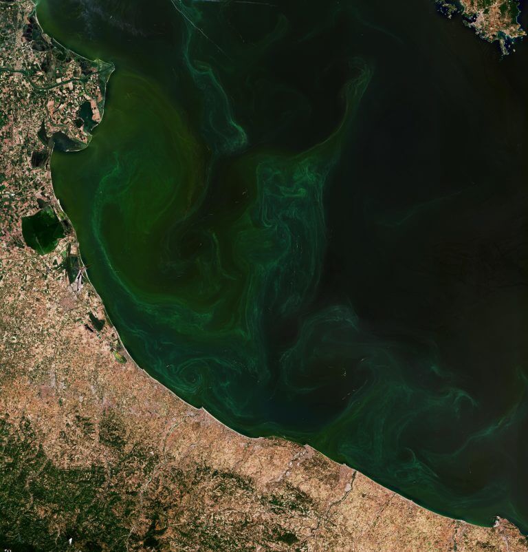
Credit: Copernicus Sentinel data (2024), processed by ESA This Copernicus Sentinel-2 image captures algal bloom swirls in...
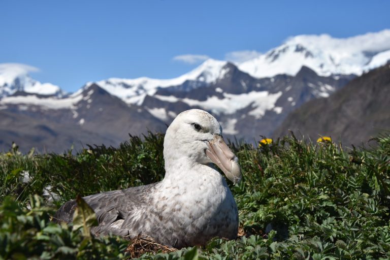
Close-up of a southern giant petrel. Credit: Professor Richard Phillips Antarctica’s rapidly receding sea ice could have...
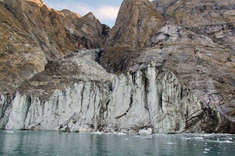
‘Before’ image of landslide site taken on Aug. 12, 2023. Credit: Søren Rysgaard In September 2023, scientists...


