

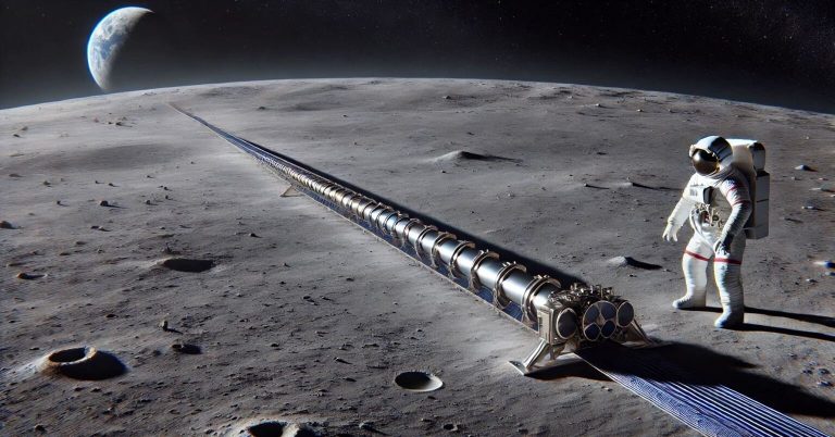
Credit: AI-generated, DALL-E illustration of a lunar electromagnetic launcher Placing a mass driver on the moon has...
Phys.org
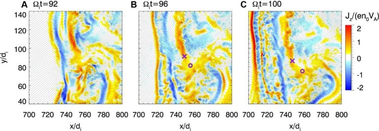
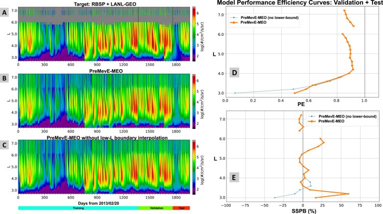
Reconnecting magnetosheath current sheet in the hybrid simulation. Credit: Prof. Lu’s team / University of Science and...
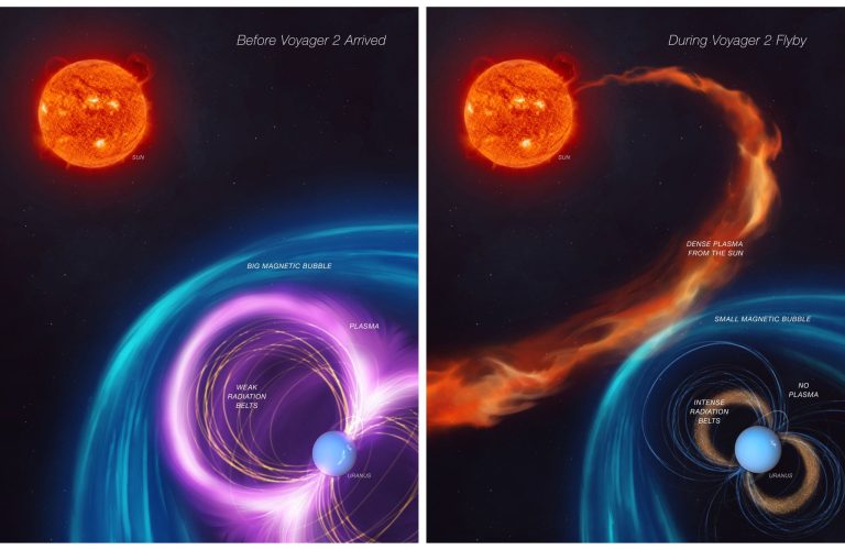
The first panel of this artist’s concept depicts how Uranus’s magnetosphere — its protective bubble — was...
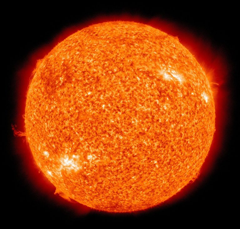
Credit: Pixabay/CC0 Public Domain Like the Earth, the sun likely has swirling polar vortices, according to new...
Gravitational lensing of distant galaxies by the galaxy cluster Abell 2390, observed by the Euclid satellite. Credit:...
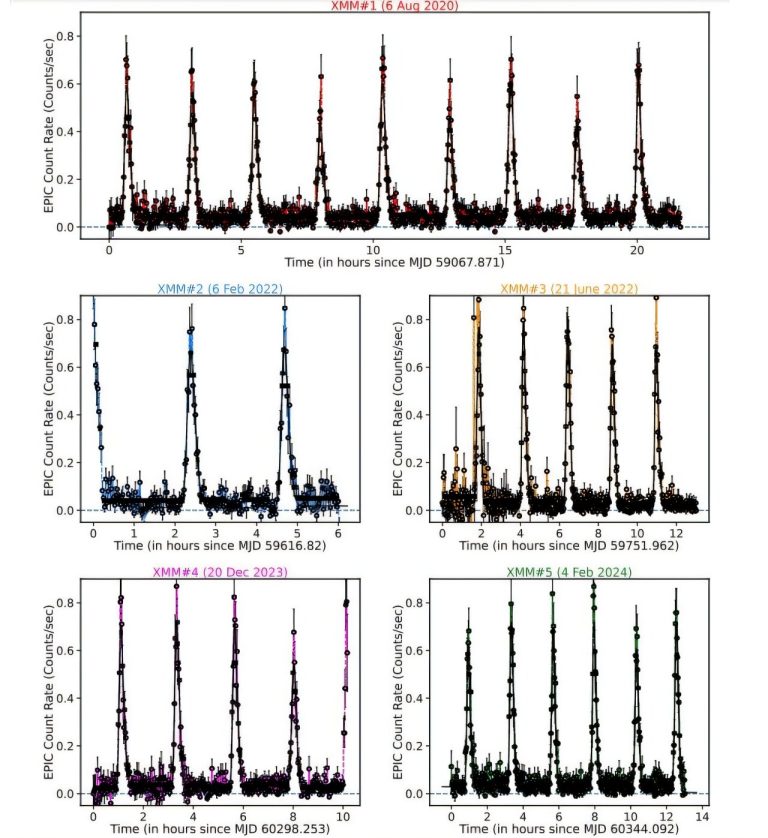
0.25-2.5 keV XMM-Newton/EPIC (pn+MOS) X-ray light curves of eRO-QPE2. Credit: Pasham et al., 2024. An international team...
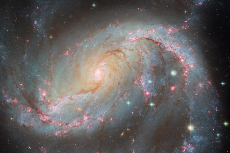
This NASA/ESA Hubble Space Telescope image captures the spiral galaxy NGC 1672 with a supernova. Credit: ESA/Hubble...
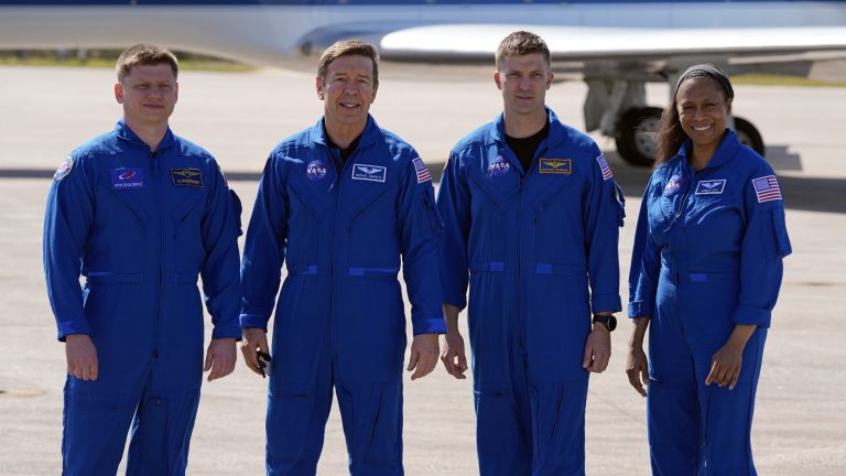
The SpaceX crew of the Dragon spacecraft, from left, cosmonaut Alexander Grebenkin, pilot Michael Barratt, commander Matthew...
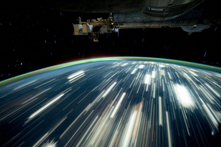
Credit: NASA/Don Pettit Earth’s city lights streak by in this long-exposure photo taken by NASA astronaut Don...


