


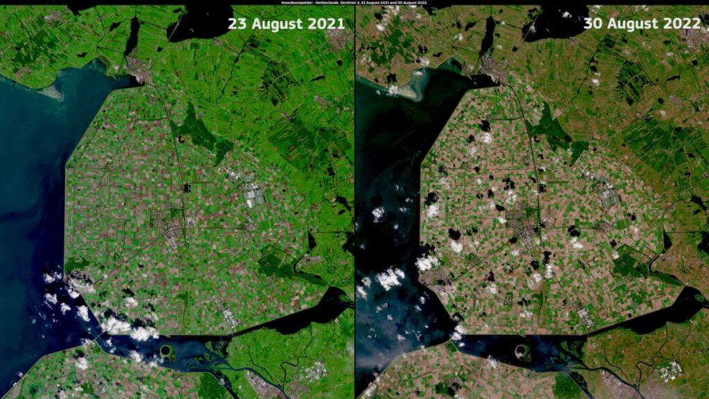


A sequence of images reveals how Europe dried up over July and August when complete lack of rain caused what has been described as the worst drought hitting the continent in 500 years.
A video tweeted by the European Union’s Copernicus Program, which operates the constellation of Earth-observing Sentinel satellites, shows how vast regions across Europe have turned from a verdant green to an arid brown between July 1 and Aug. 31.
“In 2022, #drought has affected the whole of Europe,” Copernicus said in the tweet.
The images, taken by the Sentinel 2 satellite, reveal significant damage to vegetation in areas in the south and east of England, northern France, vast swaths of Germany, Poland and Eastern Europe.
Related: Satellite view reveals scope of apocalyptic flooding in Pakistan
Alongside the stark satellite data, the Global Drought Observatory indicates (opens in new tab) that 47% of Europe was considered to be in warning conditions in August, meaning a lack of soil moisture and negative effects on vegetation.
The drought has been described as the worst to hit Europe in 500 years. Water levels in rivers including the Rhine, Danube and Po dropped so low as to close the waterways for traffic, while the exceptionally hot and dry weather has greatly increased the risk of forest fires.
The European summer this year is thought to be the driest since a mega-drought that hit the continent in 1540.
Follow us on Twitter @Spacedotcom and on Facebook.