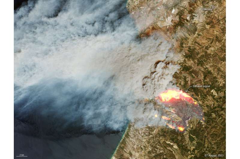
With Portugal in the grip of a heat wave, a wildfire broke out on 5 August south of Odemira in the Alentejo region in southern Portugal. This image, captured by the Copernicus Sentinel-2 satellite mission, shows the fire on 7 August.
The smoke billowing from the fire and being blown towards the Atlantic is clear to see in this true color Sentinel-2 image. The image has been overlaid with information from the satellite instrument’s shortwave infrared channels to highlight the emitting heat sources which, in this case, can be linked to the fire front.
News reports state that there are hundreds of firefighters trying to tackle the blaze, but fire is spreading southwards towards the Algarve, a tourist destination.
Other southern European countries have also been grappling with fierce temperatures and fires in recent weeks. In fact, according to the World Meteorological Organization, July 2023 is likely to have been the hottest month on record.
The Copernicus Sentinel-2 mission is based on a constellation of two identical satellites, each carrying an innovative wide swath high-resolution multispectral imager with 13 spectral bands for monitoring changes in Earth’s land and vegetation.
Provided by
European Space Agency
Sentinel-2 captures Portugal wildfire (2023, August 9)
retrieved 27 September 2023
from https://phys.org/news/2023-08-sentinel-captures-portugal-wildfire.html
part may be reproduced without the written permission. The content is provided for information purposes only.