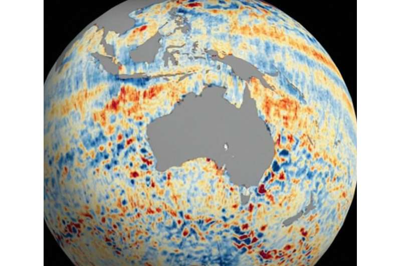
The Surface Water and Ocean Topography (SWOT) satellite is sending down tantalizing views of Earth’s water, including a global composite of sea surface heights. The satellite collected the data visualized above during SWOT’s first full 21-day science orbit, which it completed between July 26 and Aug. 16.
SWOT is measuring the height of nearly all water on Earth’s surface, providing one of the most detailed, comprehensive views yet of the planet’s oceans and freshwater lakes and rivers. The satellite is a collaboration between NASA and the French space agency, CNES (Centre National d’Études Spatiales).
The animation shows sea surface height anomalies around the world: Red and orange indicate ocean heights that were higher than the global mean sea surface height, while blue represents heights lower than the mean. Sea level differences can highlight ocean currents, like the Gulf Stream coming off the U.S. East Coast or the Kuroshio current off the east coast of Japan. Sea surface height can also indicate regions of relatively warmer water—like the eastern part of the equatorial Pacific Ocean during an El Niño—because water expands as it warms.
The SWOT science team made the measurements using the groundbreaking Ka-band Radar Interferometer (KaRIn) instrument. With two antennas spread 33 feet (10 meters) apart on a boom, KaRIn produces a pair of data swaths (tracks visible in the animation) as it circles the globe, bouncing radar pulses off the water’s surface to collect surface-height measurements.
“The detail that SWOT is sending back on sea levels around the world is incredible,” said Parag Vaze, SWOT project manager at NASA’s Jet Propulsion Laboratory in Southern California. “The data will advance research into the effects of climate change and help communities around the world better prepare for a warming world.”
Provided by
NASA
See SWOT mission’s unprecedented view of global sea levels (2023, October 30)
retrieved 31 October 2023
from https://phys.org/news/2023-10-swot-mission-unprecedented-view-global.html
part may be reproduced without the written permission. The content is provided for information purposes only.