


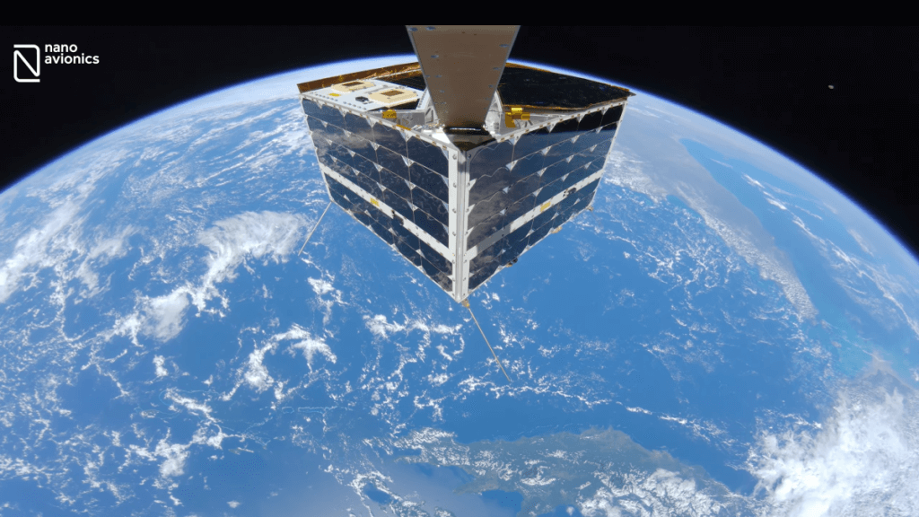
A new spacecraft selfie shows the machine in glorious 4K resolution above Australia’s Great Barrier Reef.
NanoAvionics, a satellite company based in the United States and United Kingdom, released a high-definition video (opens in new tab) from space Wednesday (June 28) showing their MP42 microsatellite (opens in new tab) flying 342 miles (550 km) above the reef and the Coral Sea which lies off the northeast coast of Australia.
The “immersive” view of Earth, captured with the assistance of a selfie stick, is the first such high-definition view of a full satellite backdropped by our planet, company officials wrote in a release that same day.
Featuring the reef as the backdrop was not coincidental. “We wanted to highlight the vulnerability of our planet and the importance of Earth observation by satellites, especially for monitoring environment and climate changes,” Vytenis Buzas, co-founder and CEO of NanoAvionics, said in the company statement (opens in new tab).


The Great Barrier Reef is the largest structure on Earth made by living organisms, spanning some 133,000 square miles (344,400 square kilometers), according to previous information (opens in new tab) from NASA’s Jet Propulsion Laboratory (JPL).
The agency studied the Great Barrier Reef in 2016 as part of its airborne CORAL mission (COral Reef Airborne Laboratory), aiming to provide a more comprehensive dataset of damage to the coral than available in space missions at the time.
Coral reefs worldwide, including this one, are all showing serious signs of decline amid human-driven global warming. Reefs are “degrading at alarming rates”, JPL stated, as they are failing to replace themselves with flat beds of algae and sand as they are supposed to.
While NanoAvionics had environmental reasons for featuring this image, the recording had engineering utility as well.
While taking the selfie, officials wrote, the satellite’s camera tested and verified satellite operations for a payload controller that aims to process some data in space before sending it down to Earth. (Such a process saves valuable time when assessing fast-changing areas on the planet.)
“The company anticipates more future usages of real satellite footage, live and recorded, such as deployment confirmation, fault detection, micro-meteorite impacts and educational purposes,” NanoAvionics officials stated.
The spacecraft launched (opens in new tab) with about 40 other small satellites aboard a SpaceX Falcon 9 rocket on April 1, flying the satellites to orbit on a mission called Transporter-4.
Follow Elizabeth Howell on Twitter @howellspace (opens in new tab). Follow us on Twitter @Spacedotcom (opens in new tab) and on Facebook (opens in new tab).