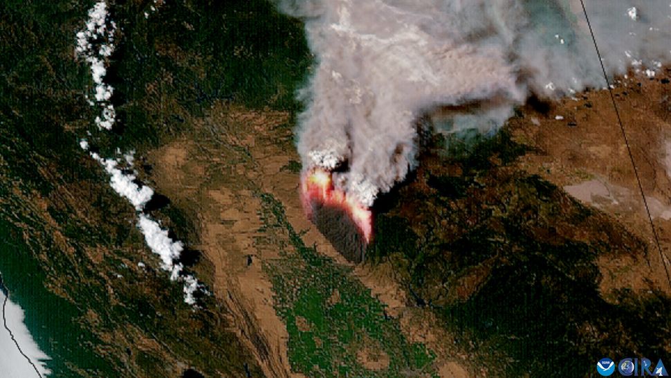
The second-largest wildfire of 2024 continues to rage in northern California, and satellites are watching the destruction unfold.
The Park Fire wildfire is currently burning north of Sacramento and has already consumed more than 560 square miles (1,455 square kilometers), an area larger than the city of Los Angeles. It is already the largest wildfire California has experienced this year. As of July 29, the fire was only 12% contained, according to InciWeb, a wildfire information service operated by the U.S. National Interagency Fire Center.
As the fire continues to rage, satellites overhead are watching the flames and smoke erupt upward. Spacecraft operated by the U.S. National Oceanic and Atmospheric Administration (NOAA) captured startling imagery on July 26 and 27, showing dense plumes of smoke rise from the flames and drift northeast across the western United States.
The Park Fire is believed to have started when a burning car was pushed into a gully at a municipal park in Chico, California. The individual responsible has been arrested, the Los Angeles Times reported.
High winds, heat and dry conditions allowed the fire to spread within days, burning over 368,256 acres (149,028 hectares), according to InciWeb.

Over 100 wildfires are currently burning across the United States. Another massive wildfire is currently burning near Jasper National Park in Alberta, Canada, forcing thousands to evacuate.
As Earth’s climate continues to change, scientists predict that wildfires will become more prevalent and more destructive. A NOAA-funded study published in 2021 found that human-caused climate change is the main driver behind increased wildfires in the western United States.
A previous NASA study found that smoke from these wildfires is warming the planet more than previously thought, by releasing dense carbon particulates into the atmosphere.