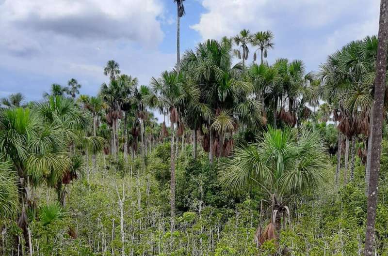
A consortium of researchers led by the University of St Andrews, Scotland, and Charles University, Prague have developed a new data-driven map which predicts substantially more peatland area in the Amazon basin than previously estimated. The high-resolution map provides the first field-data-driven extent of peatlands in the Amazon basin and will be useful for future research and policy on the vulnerability of peatlands to climate change and human impacts.
The map of the Amazon Basin reveals a far greater extent of peatlands than previously documented. The new research article, published in Environmental Research Letters, sheds light on a critical carbon store and ecosystem potentially vulnerable to climate change and human impacts.
Peatlands are waterlogged landscapes that accumulate partially decomposed plant matter over thousands of years. They store vast amounts of carbon and play a crucial role in regulating the global climate. However, their distribution in the Amazon Basin, a region critical for global climate stability, has been poorly understood.
An international team of peatland researchers, led by Dr. Adam Hastie from Charles University, Prague, Czech Republic, compiled data from over 2,400 ground reference points across the Amazon. These points showing the ecosystem type with or without peat were combined with satellite imagery and other environmental data to create a high-resolution map of peatland extent.
The new map estimates that peatlands cover approximately 251,000 square kilometers of the Amazon Basin, an area larger than Belgium. This is significantly greater than previous estimates, suggesting that vast areas of peatland remain undocumented, particularly in northern Brazil and Bolivia.
“Our study highlights the importance of field data collection for improving our understanding of peatland distribution which can help set priorities for climate change mitigation including land-management strategies, research, and policy,” says Dr. Hastie.
“This peatland map also provides opportunities to strengthen relationships with local communities who live in and around these ecosystems, to prevent irreversible damage to healthy peatlands and restore those that may be degraded,” adds Dr. Ethan Householder, scientist at the Karlsruher Institut für Technologie in Germany.
“Armed with this knowledge, policy makers and researchers are better equipped to develop and implement policies and strategies to conserve and sustainably manage peatlands and avoid the release of thousands of years of stored CO2 which would have a catastrophic impact on global climate,” says Dr. Eurídice Honorio Coronado, a tropical ecologist based at the Royal Botanic Gardens, Kew.
“This work will guide new exploration of areas that are predicted to contain peat, but have not yet been sampled and provides opportunities for capacity building of early career researchers and new international collaborations to implement new technologies for peat detection,” adds Gabriel Hidalgo Pizango, researcher at the Instituto de Investigaciones de la Amazonía Peruana in Peru.
The Amazon’s peatlands face a number of threats, including climate change, deforestation, and drainage for agriculture. The new map can help identify areas of peatland at greatest risk and inform strategies for their protection.
“The new map will be essential for guiding future research and conservation efforts in the region,” says Dr. Ian Lawson, senior lecturer in the School of Geography and Sustainable Development at the University of St Andrews.
With a more comprehensive picture of peatland distribution, researchers can now delve deeper into understanding the role these ecosystems play in the Amazon’s overall health and function. This knowledge is vital for informing conservation strategies that protect not only the peatlands themselves but also the diverse species and ecological processes that depend on them.
More information:
Adam Hastie et al, A new data-driven map predicts substantial undocumented peatland areas in Amazonia., Environmental Research Letters (2024). DOI: 10.1088/1748-9326/ad677b
Journal information:
Environmental Research Letters
Provided by
Charles University
New data-driven map reveals extensive peatlands in Amazon Basin (2024, July 29)
retrieved 29 July 2024
from https://phys.org/news/2024-07-driven-reveals-extensive-peatlands-amazon.html
part may be reproduced without the written permission. The content is provided for information purposes only.