


PAR Technology Corporation (NYSE: PAR) has noted that their wholly-owned subsidiary, PAR Government Systems Corporation (PGSC), has incorporated BlackSky’s (NYSE: BKSY) commercial satellite data into the Sit(x)™ cloud-native situational awareness suite.

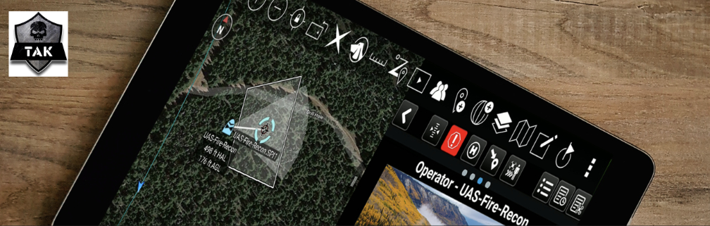
This makes it possible for tactical and operational end users to access near real-time imagery on the Tactical Assault Kit (TAK) mobile platform.


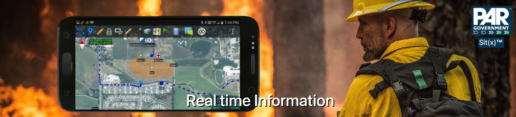
“As the name implies, Sit(x) can handle the situational awareness demands of any situation,” said PAR Government President, Michael Nelson. “Sit(x) helps front-line commanders and warfighters make faster and better decisions by enabling two-way sharing of vital information. We are thrilled to team up with BlackSky and add their phenomenal space-based image products into the same tactical devices in use by over a quarter million people today.”
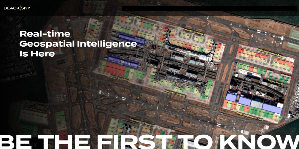
“Customers experience a force-multiplying first-to-know advantage with BlackSky’s proprietary high-revisit satellite constellation,” said BlackSky Chief Revenue Officer, J.R. Riordan. “Together with PAR Government, we’re improving the tactical ISR experience by providing insights and real-time analytics to those serving on the front lines when they need it most.”
Incorporating BlackSky imagery and derived products into Sit(x) is one of the first steps in turning the server into a geospatial data marketplace where users can access a variety of commercial imagery sources as near real-time base maps and other digital data.
At GEOINT 2022 participants can experience how Sit(x) displays the real-time locations of personnel and resources overlaid on a high-resolution multispectral BlackSky satellite image of Ukraine. To participate in the demo, attendees are invited to download the ATAK app and the companion app Sit(x) TeamConnect On-The-Go (OTG) from the Google Play Store, or Sit(x) for iOS from the Apple App Store, to their mobile devices where they can view imagery and communicate with other GEOINT attendees.


The Sit(x) demonstrations will occur in Booth 504.

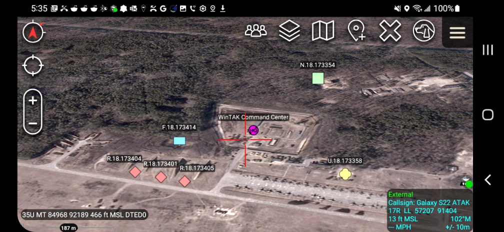
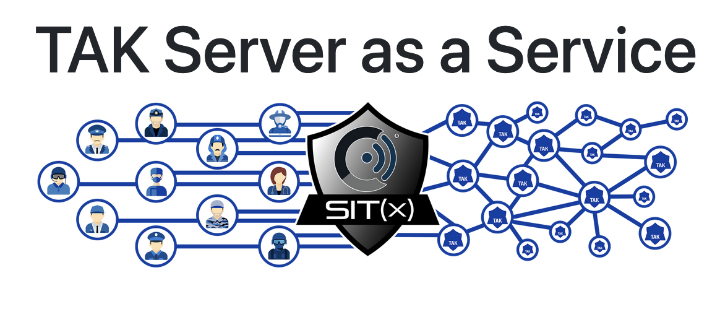
Sit(x) is a commercial Server-as-a-Service solution based on the TAK platform developed by PAR Government for the U.S. Defense & Intelligence Community. Sit(x) establishes real-time communication and information sharing among otherwise non-federated military and civilian personnel during rapidly evolving situations, both planned and unexpected. With Sit(x), individuals and teams can communicate via standard personal computers and handheld mobile devices by voice, text, or symbology. They can share real-time full-motion video (FMV), GIS layers, airborne/drone imagery, GPS locations, raster maps, photos, and documents and now satellite imagery across their defined group. PAR developed Sit(x) as an affordable and easy to use cloud-based alternative to TAK Server for organizations. Sit(x) is securely hosted in the AWS Gov Cloud with all hardware/software management handled by PAR. Fully secure and compatible with ATAK, WinTAK, and the just released iTAK, Sit(x) can be accessed via free downloadable gateway applications.