


A joint NASA-French satellite designed to map Earth’s water in amazing detail is struggling to turn on an instrument during its setup in orbit.
The Surface Water and Ocean Topography (SWOT) satellite‘s main science instrument, called KARIN (Ka-band Radar Interferometer), “unexpectedly shut down” due to a problem with the high-power amplifier subsystem, agency officials wrote in a Feb. 23 blog post (opens in new tab).
There is no cause yet found for the issue, but “engineers are working systematically to understand the situation and to restore operations,” NASA officials wrote. The team is aiming to rectify the issue, as the instrument is key to mapping surface water in two dimensions to see how climate change is affecting Earth‘s water levels.
Related: Watch NASA’s SWOT satellite unfold in space in stunning video
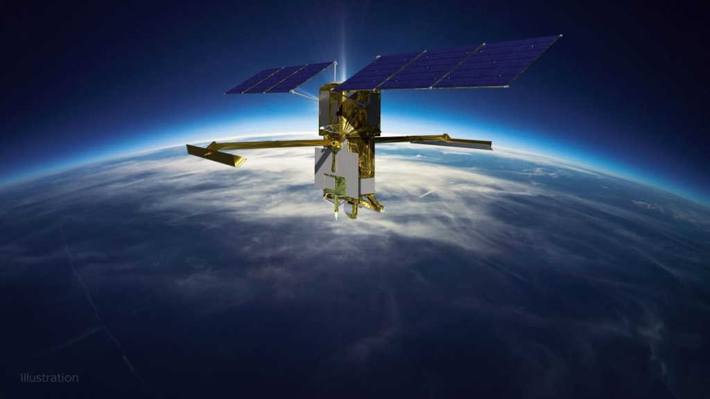
KARIN includes twin antennas working roughly 33 meters (10 meters) apart, or half the length of a tennis court. When functional, one of the antennas generates a radar pulse that reflects off the Earth, then both antennas pick up the signal.
“Once the KARIN instrument is up and running again, the mission will continue with its commissioning and calibration activities—planned March through June—to ensure data accuracy in preparation for the beginning of science operations in July 2023,” NASA officials wrote.
A SpaceX Falcon 9 rocket launched SWOT satellite from at Vandenberg Space Force Base in California on Dec. 16. The multi-agency SWOT is co-led by NASA and France’s space agency (CNES). Measuring water levels is key to helping global partners understand how carbon dioxide, a greenhouse gas, plays a role in the global warming that affects water levels.
Once ready for operations, SWOT is supposed to examine 1.3 million miles (2.1 million km) of rivers, along with coastlines and millions of lakes that are hard to sample up close. NASA also plans to make the information publicly available, alongside intuitive tools, to encourage communities to use the information for planning and tracking local water levels.
Elizabeth Howell is the co-author of “Why Am I Taller (opens in new tab)?” (ECW Press, 2022; with Canadian astronaut Dave Williams), a book about space medicine. Follow her on Twitter @howellspace (opens in new tab). Follow us on Twitter @Spacedotcom (opens in new tab) or Facebook (opens in new tab).