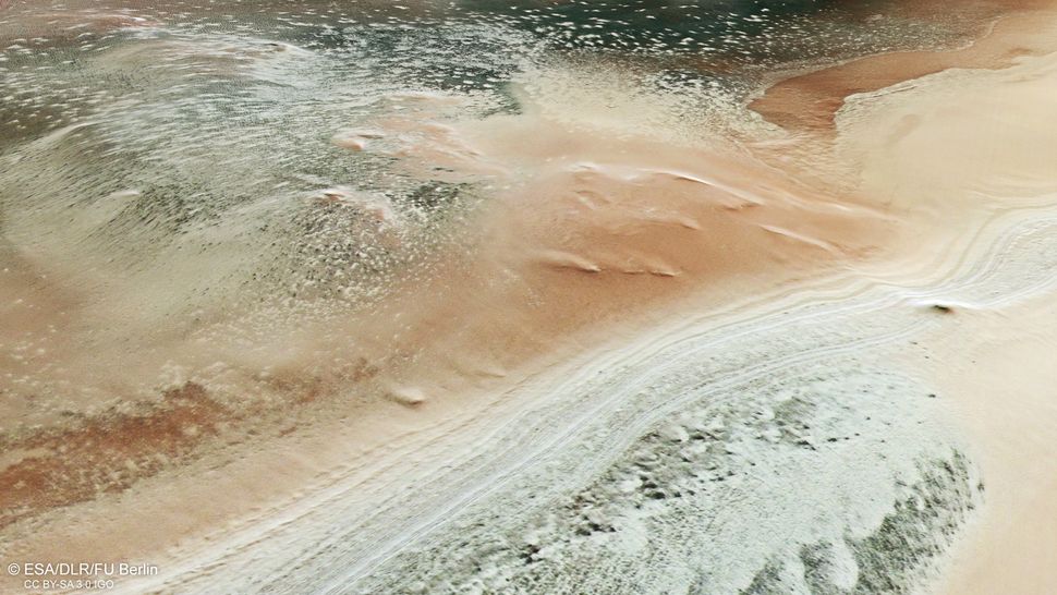
Two European Mars orbiters spied a variety of cryptic surface features poking up through melting ice across the Red Planet’s south pole as spring rolled into the region.
The European Space Agency‘s (ESA) Mars Express mission captured images of the Australe Scopuli region near the south pole of Mars on April 2, 2024, when it was spring in the planet’s southern hemisphere.
The newly released photos, taken using Mars Express’ High Resolution Stereo Camera (HRSC), capture seasonal polar caps composed mainly of carbon dioxide ice with some water ice. In spring, the ice partially sublimates, meaning it turns directly from solid ice into vapor, which releases large amounts of gas into the thin Martian atmosphere, ESA officials said in an Oct. 9 statement.

Cooler autumn temperatures then cause the vapor to condense and form thick, widespread polar caps as the southern hemisphere enters its winter season. This freeze-thaw cycle creates a “variety of curious surface features,” ESA officials said. “Some of these features are surprisingly dark compared with their icy surroundings, earning their nickname of ‘cryptic terrain,'” the statement added.
Related: Mars Express orbiter suggests evidence of ancient microbial life, water and volcanism on Red Planet
The imagery shows thick layered deposits with trapped dust on the left in contrast to smooth layered deposits on the right side. Located in the center of the images is the unusually darker terrain, which, when zoomed in, appears to have patterns of varying polygon shapes with icy edges that are believed to form from freeze-thaw cycles over several years, or even centuries.
ESA’s Trace Gas Orbiter (TGO) also observed the curious landforms. The high-resolution TGO images, taken of a different area of Mars‘ southern hemisphere, offer an up-close view of the frost-fringed polygons.
The newly released images also capture fan-shaped deposits ranging between tens of meters to several hundreds of meters in size and jets created by trapped vapor bursting through the top melting layer, carrying dark dust from the ground below. When this darker material settles on the surface, it absorbs more sunlight, causing the Martian ice to melt faster and the dark material to sink through the ice.
Studying the many different icy features on Mars can help researchers better understand the planet’s climate history, ESA officials said.