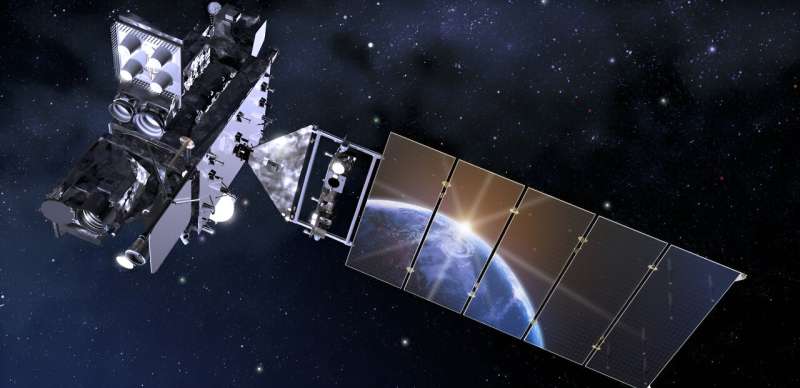
In a study published in Advances in Atmospheric Sciences (AAS) on Dec. 6, Prof. Ming Xue and his team from the University of Oklahoma spearhead research focusing on harnessing the power of Geostationary Operational Environmental Satellite “R-series” (GOES-R) lightning flash observations to improve thunderstorm forecasting through numerical weather prediction models.
A geostationary satellite, stationary relative to the Earth over the equator, offers an extensive view spanning approximately 100 degrees in longitude, covering a large area between about 50 degrees North and South latitude. Equipped with a lightning mapper capable of detecting and recording lightning flashes every 20 seconds, day and night, with high spatial resolutions across land and oceans, this satellite-derived information is invaluable in detecting rapidly developing thunderstorms.
Prof. Xue’s team developed an operational data assimilation system called the Gridpoint Statistical Interpolation (GSI), with capabilities to directly assimilate the GOES-R Geostationary Lightning Mapper (GLM) flash extent density (FED) data.
Extending their earlier work developing and evaluating FED assimilation capabilities using the ensemble Kalman filter (EnKF) method within GSI, this paper published in AAS develops and tests FED assimilation capabilities using the hybrid ensemble-variational (EnVar) method which combines the strengths of EnKF and variational methods.
The results show that the implementation of the EnVAR assimilation capabilities are successful, and positive impacts on the forecasting of a supercell thunderstorm are achieved with the assimilation of the lightning data. The paper further compares the performance of EnVar with those of EnKF and 3DVar (three-dimensional variational) methods, scrutinizing differences through single-observation experiments.
The findings indicate that analysis increments from PEn3DVar tend to be larger than those from EnKF, primarily due to differing localization strategies and horizontal integration limits within the FED observation operator. Overall, the forecast performance of EnVar is comparable to those of EnKF and a version of EnKF that employs a deterministic forecast as the background, suggesting correct implementation of the EnVar algorithm.
“Given that vast spatial coverage and high temporal resolution of the lightning mapper data collected by geostationary satellites, thunderstorm prediction can be significantly improved by utilizing such data in storm-scale numerical weather prediction models, especially over regions where operational weather radar observations are lacking, which is still the case in most countries,” Prof. Ming Xue says.
“The GOES-R lightning mapper covers as much of South America as North America, and the data could be used to improve forecasts over South America too, thereby improving preparedness and reducing economical losses due to severe weather.”
Meanwhile, the data also offer critical insights into storm development, aiding meteorologists in tracking severe weather events and providing timely warnings.
This new study not only highlights the potential of satellite data integration but also signifies a step forward in unraveling the complexities of storm prediction. These advancements promise a safer and more informed future for communities susceptible to the impacts of severe weather phenomena.
“Encouraged by these results, weather services in different countries are also considering putting similar lightning mapper instruments on geostationary satellites. Recently, members of our research team were invited to present and discuss our work at an international workshop emphasizing the use of lightning data in models,” Prof. Xue added.
Prof. Peng Zhang, Deputy Director of National Satellite Meteorological Center at China Meteorological Administration and a leading expert on satellite calibration and validation, said, “Recognizing the vital role of satellite-based lightning observations in monitoring and forecasting convective systems, the Coordination Group for Meteorological Satellites (CGMS) encourages satellite agencies to enhance lightning monitoring capabilities. Fengyun-4 meteorological satellite of China already carries a lightning mapper, similar to the one on board GOES-R.”
More information:
Rong Kong et al, Assimilation of GOES-R Geostationary Lightning Mapper Flash Extent Density Data in GSI 3DVar, EnKF, and Hybrid En3DVar for the Analysis and Short-Term Forecast of a Supercell Storm Case, Advances in Atmospheric Sciences (2023). DOI: 10.1007/s00376-023-2340-2
Journal information:
Advances in Atmospheric Sciences
Provided by
Chinese Academy of Sciences
Improving thunderstorm prediction by watching lightning flashes from space (2023, December 8)
retrieved 9 December 2023
from https://phys.org/news/2023-12-thunderstorm-lightning-space.html
part may be reproduced without the written permission. The content is provided for information purposes only.