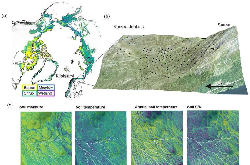
A new study investigates the sinks and sources of key greenhouse gases of carbon dioxide, methane, and nitrous oxide in the Arctic landscape with a spatial resolution of only a few square meters. Vegetation and soil conditions explain the differences in greenhouse gas emissions.
Arctic soils store a significant amount of carbon and nitrogen, some of which may be released into the atmosphere due to climate change. These emissions would further accelerate global warming.
“By combining field measurements and satellite data with machine learning methods, we were able to map greenhouse gas fluxes in an Arctic region,” says researcher Anna-Maria Virkkala, the lead author of the article.
The study extensively examined various environments where soil moisture, nutrient levels, and vegetation vary significantly even over short distances. The results have been published in the journal Biogeosciences.
According to the findings, the majority of the studied environments in Northern Finland act as sinks during the summer, meaning they absorb more greenhouse gases from the atmosphere into the soil and vegetation than they release into the atmosphere. Plants play a crucial role in this process by sequestering carbon dioxide from the atmosphere.
“Additionally, microbes take up methane in dry shrubland areas, which is an interesting and relatively understudied phenomenon,” notes Virkkala.
A small portion of the investigated area acted as a source of greenhouse gases, releasing more gases into the atmosphere than they absorbed. This happened occasionally in wetlands that had high methane emissions. Nitrous oxide emissions were low and associated with peatland environments. Carbon dioxide sources were minimal during the summer but could be found in sparsely vegetated areas.
“Recent studies suggest a potential weakening of sinks and strengthening of sources in the Arctic region, but there is considerable uncertainty in these findings. The methods and data used in this study aim to reduce this uncertainty, indicating that at least during the summer, parts of the Arctic region may still function as greenhouse gas sinks,” says Professor of Physical Geography Miska Luoto from the University of Helsinki.
The research team aims to continue developing datasets and methods at high spatial and temporal resolution, with the goal of monitoring greenhouse gas emissions across all Arctic regions in near-real time. “This would be a significant step forward in greenhouse gas emission monitoring,” says Virkkala.
More information:
Anna-Maria Virkkala et al, High-resolution spatial patterns and drivers of terrestrial ecosystem carbon dioxide, methane, and nitrous oxide fluxes in the tundra, Biogeosciences (2024). DOI: 10.5194/bg-21-335-2024
Provided by
University of Helsinki
Improving Arctic greenhouse gas sink and source estimates with field measurements, remote sensing (2024, February 1)
retrieved 2 February 2024
from https://phys.org/news/2024-02-arctic-greenhouse-gas-source-field.html
part may be reproduced without the written permission. The content is provided for information purposes only.