

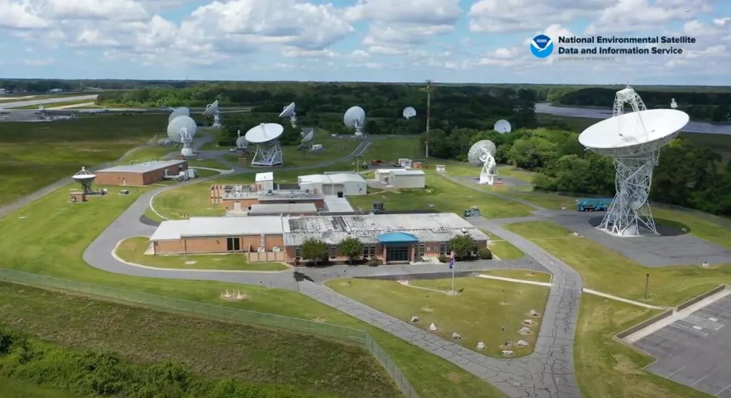


With the upcoming launch of NOAA’s new GOES-T satellite, staff at ground stations such as NOAA’s Wallops Command and Data Acquisition Station (WCDAS) located at NASA’s Wallops Flight Facility are in full swing preparing for the event.
Although Wallops launches smaller rockets as well as research aircraft, unmanned aerial systems, and high-altitude balloons, the facility also supports NOAA’s satellite tracking and commanding capabilities.
We spoke with Gregory Johnson, a GOES Ground System Engineer, and Jesse Speidel, Chief of Operations, about just what goes on at Wallops before and after a satellite launch.
First however, they explained that ground stations, like Wallops, are basically radio stations that communicate with satellites from the ground by transmitting and receiving radio waves via large parabolic antennas. Wallops tracks many satellites orbiting Earth this way, as well as deep space satellites that monitor solar activity. The ground stations can send commands to the satellites as well as receive data from them that they then send to be processed.
Prelaunch, these antennas must be thoroughly checked and tested to make sure they are fully functional. Staff must certify that each can properly receive and transmit information and validate that all specifications are met. They must also make sure that they are able to track the satellite accurately.
Once the ground station starts detecting GOES-T after launch, it will take the satellite another 9 to 10 days days to reach a temporary location at 89.5 degrees west longitude, which is over the center of the U.S. Here, the satellite will undergo Post-Launch Checkout (PLC) Post Launch Testing (PLT), where all of its instruments will be tested and calibrated in space with the assistance of a specialized software suite. Before this software was developed, it would take over a month to process the data. Now, it can be done in just two weeks.
After PLC PLT is complete, the satellite will be moved and eventually replace GOES-17 in the GOES West position, where it will keep watch over the Pacific Ocean, the western U.S., Alaska, and Hawaii.
“This is an exciting time,” said Johnson. “With a new satellite launch, everyone is waiting to see the first image come down. We’re excited to see all this collaboration come together.”
Explore further
National Environmental Satellite, Data, and Information Service
How the Wallops Command and Data Acquisition Station prepares for GOES-T satellite launch (2022, March 1)
retrieved 8 March 2022
from https://phys.org/news/2022-03-wallops-acquisition-station-goes-t-satellite.html
part may be reproduced without the written permission. The content is provided for information purposes only.