The moon’s north and south poles are in constant nightfall, with sunken places in these regions never receiving a drop of direct sunlight.
NASA wants astronauts to explore near the lunar south pole as early as 2025 because the area is thought to have ice buried below the surface. If the frozen water there could be excavated and collected, it would be an important resource for human explorers. Scientists say something as basic as H2O could potentially be converted into oxygen, drinking water, and fuel.
But studying these permanently shadowed craters from space presents an obvious challenge: How do you map out the details of the terrain in darkness?
Through a partnership with South Korea, NASA is now getting bright, detailed images of potential landing sites. The Korean spacecraft Danuri, which launched last summer, has orbited the moon since December 2022(Opens in a new tab). A camera on the orbiter was designed specially to take super light-sensitive photos of the environment.

Credit: NASA / KARI / Arizona State University illustration
The so-called ShadowCam(Opens in a new tab), funded by NASA, is 200 times more sensitive to light than its predecessor technology onboard the Lunar Reconnaissance Orbiter(Opens in a new tab). Even without direct sunshine, the instrument can pull in light dimly reflected off nearby mountains and crater rims. Arizona State University and Malin Space Science Systems developed the camera.
Is there ice on the moon?
ShadowCam is on the hunt for ice, taking photos that will help mission planners scope out potential areas rich with deposits. Scientists will study seasonal changes and take measurements within the darkened moon craters.
“Future missions in deep space will be safer and more affordable if we have the capability to harvest lunar resources,” said Jason Crusan, NASA’s former director of advanced exploration systems, in a 2017 statement(Opens in a new tab). “ShadowCam has the potential to greatly increase our understanding of the quality and abundance of those resources in these regions.”
Credit: KARI
Want more science and tech news delivered straight to your inbox? Sign up for Mashable’s Top Stories newsletter today.
The photos should ultimately help NASA narrow down where to drill. In August 2022, the agency announced 13 potential south pole landing sites for the Artemis III mission, the first to send astronauts to the lunar surface in a half-century. While on the moon for nearly a week, the astronauts, including the first woman and first person of color to walk on the moon, would collect samples to bring home for analysis.
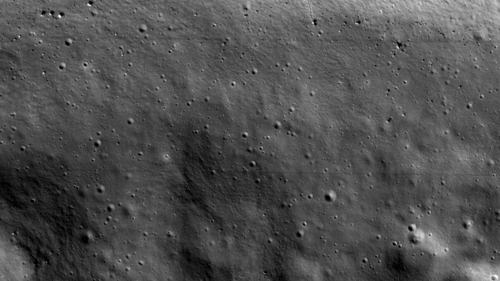
Since Danuri arrived at the moon, it has begun snapping test photos to get calibrated. It recently took a picture of a lunar dimple known as Shackleton Crater(Opens in a new tab). The image is so bright, the team can make out fine details like the tracks of a 16-foot-wide boulder that skidded down the steep crater wall to the floor.
Credit: NASA / KARI / Arizona State University
Shadowcam has proven it can indeed see better in the dark than NASA’s Lunar Reconnaissance Orbiter camera. A side-by-side comparison (above) shows how the new camera, right, captures the interior of the crater.
Because this crater is relatively small, the temperature gets a little too warm in the summer to keep ice stable, rising above -261 degrees Fahrenheit, according to a recent Arizona State post(Opens in a new tab) on the project.
“This area is not the most likely host for frost or ice at the surface,” the post said. “Perhaps elsewhere in this crater where temperatures are lower, there might be ice or frost waiting to be seen.”

