


Scientists have created a new high-resolution map of the moon using data from China’s recent lunar missions.
The detailed map was created using data primarily from China’s Lunar Exploration Program collected over the past 15 years, and was supplemented by high-quality data from international exploration missions from the U.S., Japan and India.
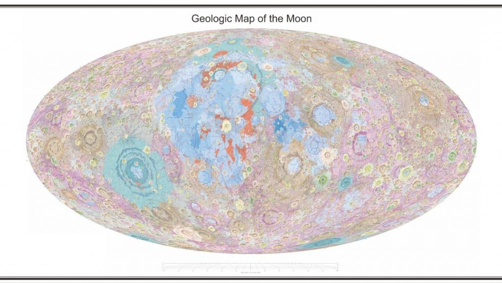
It reveals geologic layers, structural features and a chronology of the moon‘s surface, and includes 12,341 impact craters, 81 impact basins, 17 rock types and 14 types of structures.
Related: Amazing moon photos from NASA’s Lunar Reconnaissance Orbiter
The map reflects “the evolution of lunar crust under igneous processes, catastrophic impacts and volcanic activities,” the research team wrote in a paper accepted for publication in the journal Science Bulletin (opens in new tab).
The map uses a Mollweide projection that creates an elliptical view of the moon; China also provided stereographic projections, separately centered on the north and south poles. Researchers could use the new work for further lunar geologic mapping and landing site selection for future missions.
The full-size map is available from the Chinese Academy of Sciences’ National Space Science Center (opens in new tab).
Follow us on Twitter @Spacedotcom and on Facebook.