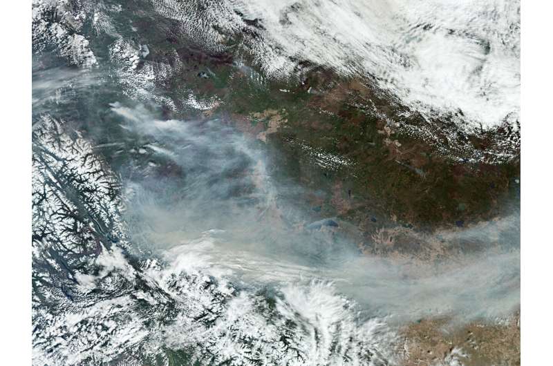
Wildfire season has arrived in full force in Canada, prompting evacuation orders and alerts in several towns in British Columbia and Alberta due to the danger of uncontrolled blazes.
Hazardous smoke from the fires has also triggered air quality alerts in Canada and the northern US. Satellite technology, including the Copernicus Sentinel-5P satellite and ESA’s Fire Atlas, plays a crucial role in monitoring these wildfires.
The 2023 wildfire season in Canada was one of the worst on record. Over the course of the fire season that started early and ended later than usual, blazes burned an estimated 18.4 million hectares. The impact on the environment, especially air quality in both Canada and the U.S., was profound.
With the 2024 wildfire season already in full swing, Canadian authorities are bracing for a challenging summer.
Wildfire season in Canada typically runs from April until September or October when cooler temperatures dampen fire activity. The early onset of these wildfires, caused by unseasonably warm temperatures and dry conditions, has raised concerns about a potentially prolonged and severe fire season ahead.
According to the Canadian Interagency Forest Fire Agency, there are around 130 wildfires currently burning across Canada, mostly in British Columbia and Alberta.
Data from Copernicus Sentinel-5P reveals the extent of air pollution caused by these wildfires. Equipped with the Tropomi instrument, the satellite provides high-resolution data on air quality by measuring gases and aerosols, including air pollutants such as carbon monoxide, nitrogen dioxide and particulate matter.
Smoke from the fires can travel vast distances, degrading air quality far from the source of the flames.
ESA’s World Fire Atlas, an essential tool in wildfire monitoring, utilizes data from the Copernicus Sentinel-3A satellite to detect and map active fires globally.
Working like a thermometer in the sky, the Sea and Land Surface Temperature Radiometer (SLSTR) on board Sentinel-3 measures thermal infrared radiation to take the temperature of Earth’s land surfaces which is used to detect the fires.
The data, which is represented in “pixels” indicate that 258 fires have been detected in Canada in 2024 (data up to 13 May). In contrast, during the 2023 wildfire season, the Atlas detected 19,487 wildfires.
As the wildfire season progresses, ESA’s World Fire Atlas continues to be a valuable resource in tracking new fire outbreaks.
Provided by
European Space Agency
Canada’s wildfire season begins (2024, May 17)
retrieved 18 May 2024
from https://phys.org/news/2024-05-canada-wildfire-season.html
part may be reproduced without the written permission. The content is provided for information purposes only.